
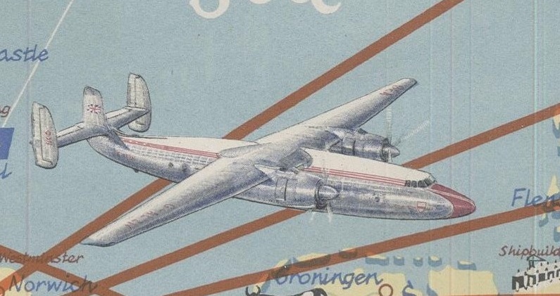
Amongst some recent donations to the Map Room have been some maps featuring planes. One appears on an Air Routes map by British European Airways. As well as the air routes and planes

BEA International Air Routes, 1954. C1 (1020)
extract from BEA map
the map also works as a tourist guide, showing areas of interest and local customs and peoples. The map goes as far south as North Africa and far enough east to include the Middle East, to continue the transport theme camel trains are featured

extract from BEA map
The second image comes from a road map of Queensland from circa 1950, which evokes images of Tintin and dashing adventures.
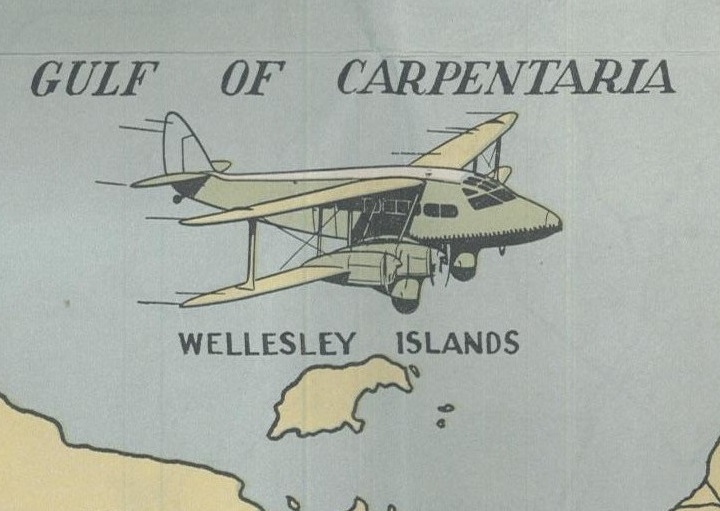
[Extract from] Vacuum Road Map of Queensland, c1950. I3:20 (61)
More planes feature in this extract from a map of the travels of Prime Minister Winston Churchill during the Second World War. The map plots the routes taken by Churchill to the various conferences and meetings between the leaders of the three great allied powers.
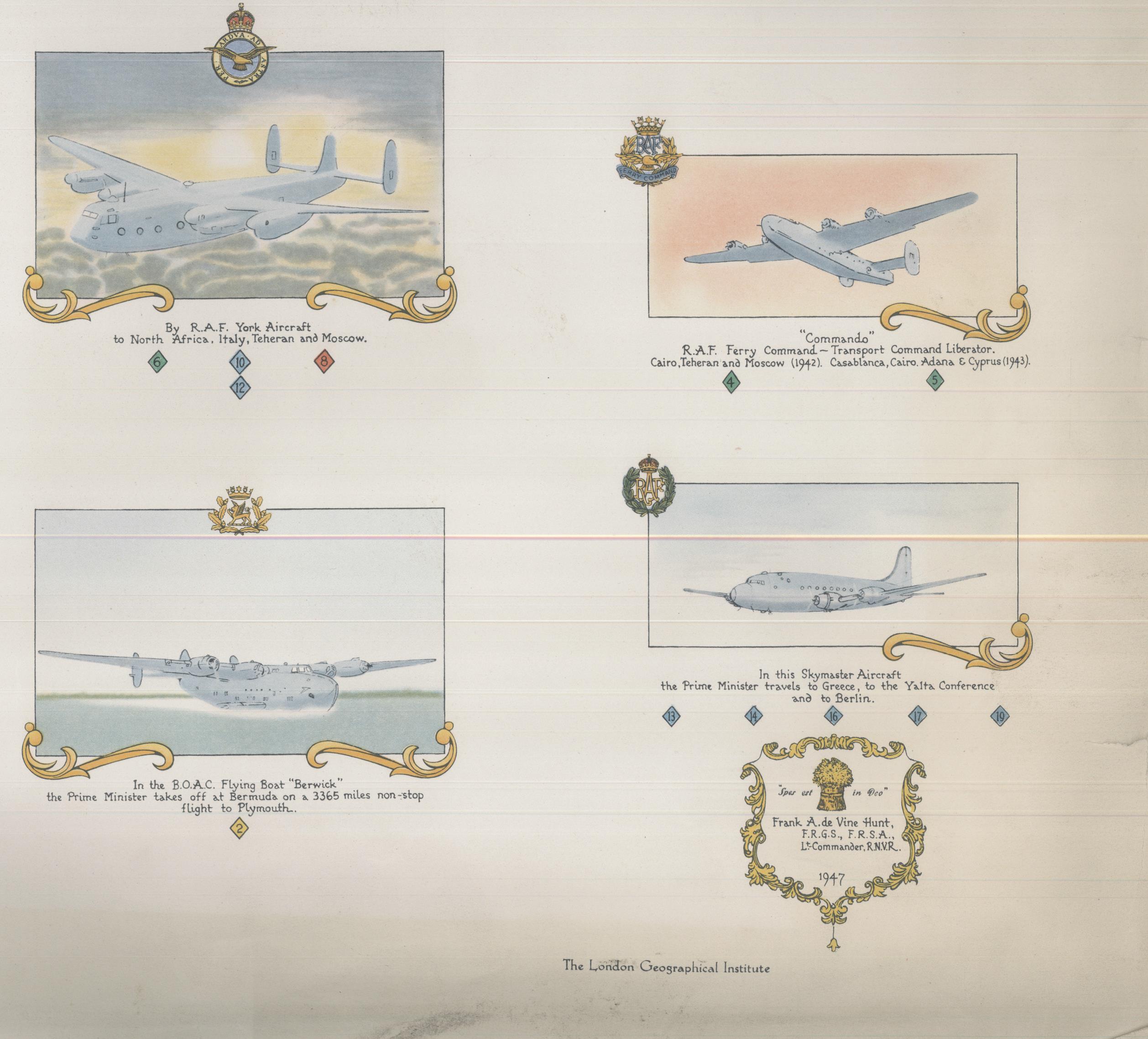
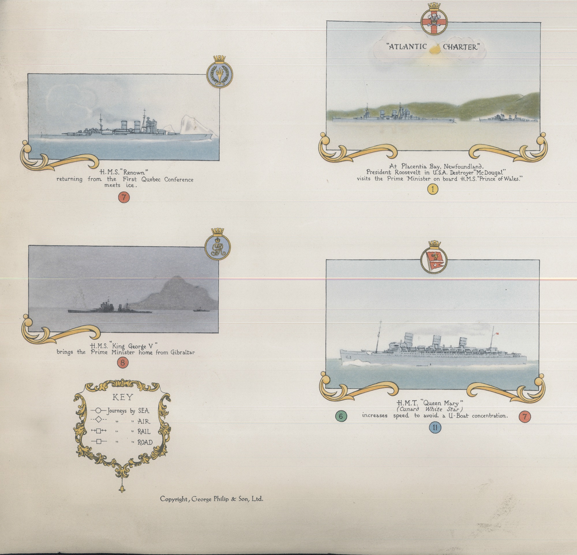
[Extracts from] Dunkirk to Berlin, June 1940 – July 1945. Journeys undertaken by the Rt. Honble. Winston S. Churchill, O.M., C.H., F.R.S., M.P., Prime Minister of Great Britain in defence of the British Commonwealth and Empire, 1947. B2 (101)
Early maps of railways sometimes included images of steam engines, we give two particularly good examples here
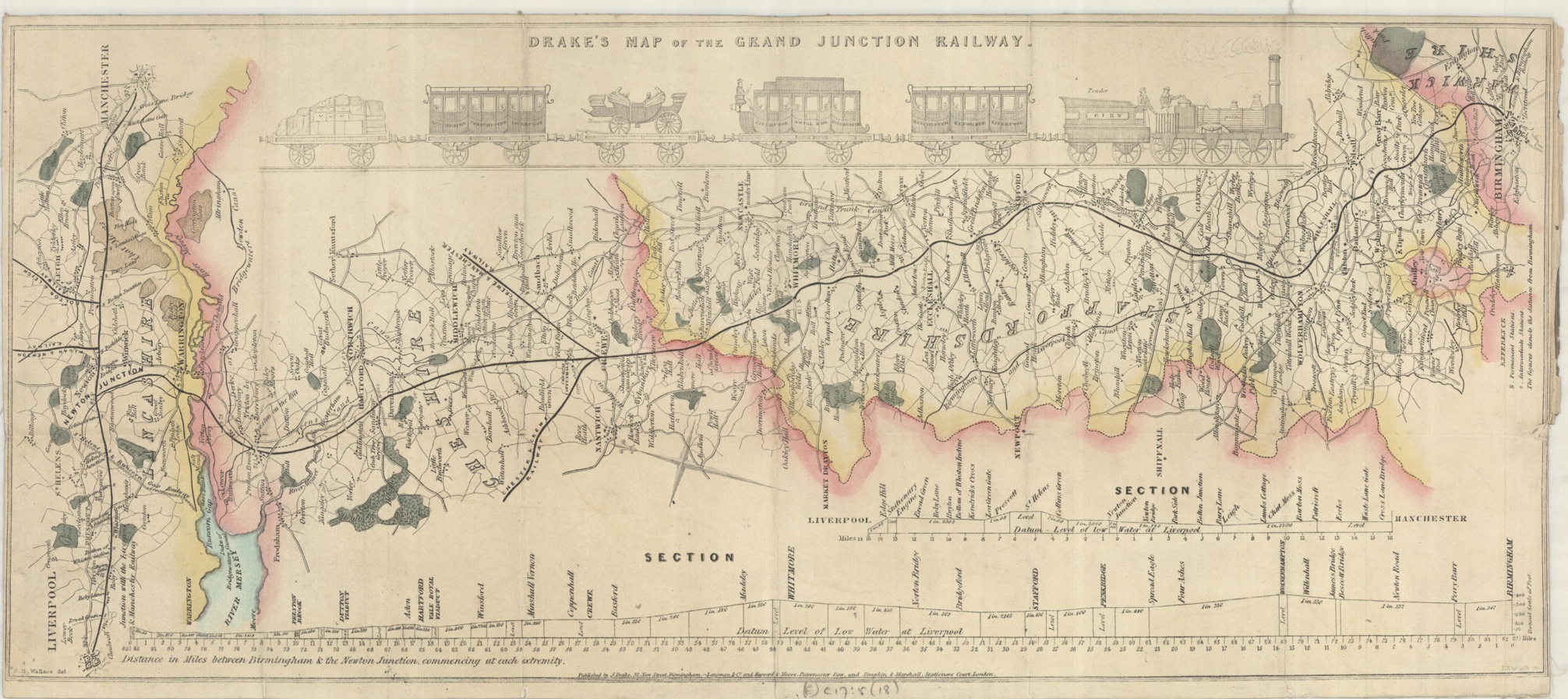
Drake’s map of the Grand Junction Railway, 1839. (E)C17:5 (18)
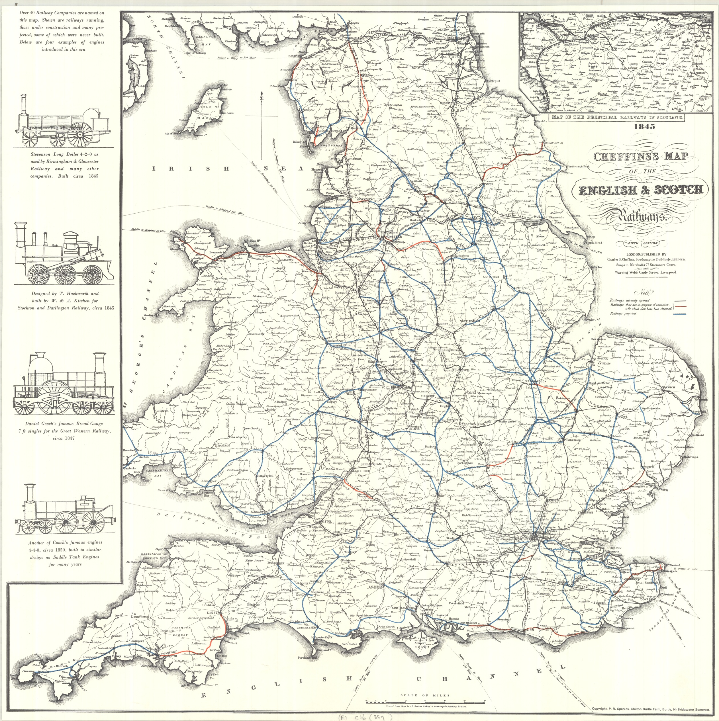
Cheffin’s Map of the English and Scotch Railways (Facs), 1845. (E)C16 (359)
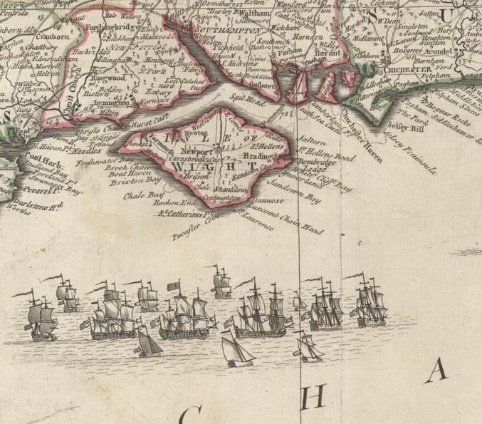
Ships feature heavily in maps of the country and any coastal county published before the coming of the railways, signifying the importance of Britain’s reliance on both trade and naval power.
[Extract from] England and Wales…by John Rocque, in four sheets, c1761. Gough Maps England and Wales 34

[Extract from] Hampshire and the Isle of Wight by E. Bowen, 1767. Gough Maps Hampshire 5

A geometrical plan…H.M.’s dockyard, nr. Plymouth, 1756. Gough Maps Devon 7
To show that road maps are no a modern invention this extract comes from a 1809 map showing stagecoach routes. There are a large number of stagecoach maps in the Bodleian collection, this is one of the few that actually has the mode of transport featured on the map itself
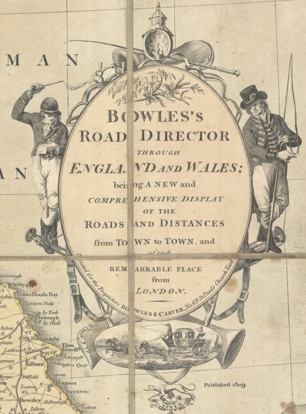
[Extract from] Bowles Road Director through England and Wales…, 1809. (E)C17 (115)
The final map featured shows a more serious scene. In an extract from a map published circa 1746 and showing events from the Jacobite Rising of 1745 two ships are engaged in battle at

[Extract from] Map showing routes of Prince Charles, c1746. Gough Maps British Isles 23.
close quarters off the South-West coast.