
To mark the opening of the Kiel Canal in June 1895 Kaiser Wilhelm II and the German Government held a regatta at the entrance to the canal, and invited representatives from the nations whose flags, pennants and ensigns are shown in the panel on the right of the map featured here, including Britain, Spain, France, the United States and Italy, to take part.
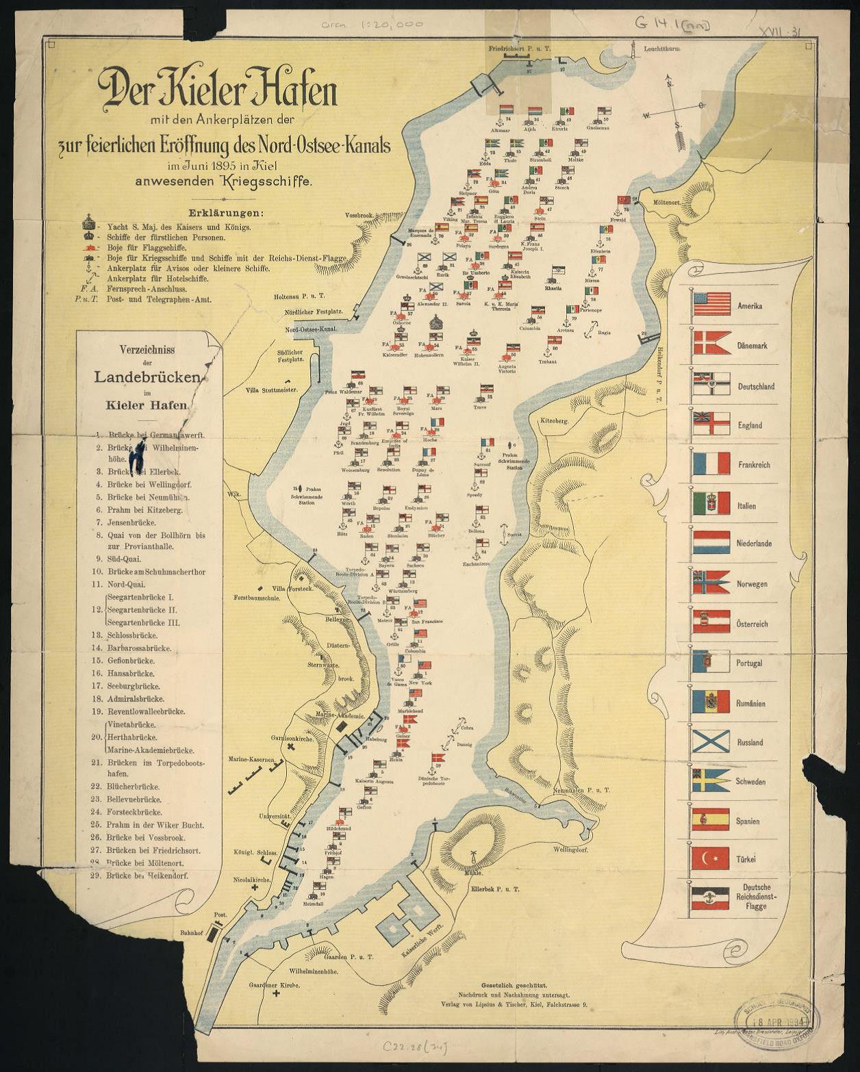
The map shows the ships of the different nations lying at anchor in the Kiel Fjord. Those with crowned heads of state onboard are indicated by the large crown symbol, ships with lesser members of royalty by a smaller crown.
The Kiel Canal is an important link between the Baltic and North Seas, and when completed enabled German ships to move between the two without making the long and often stormy passage around the coast of Denmark. Two years after the 1895 celebrations Germany began to enlarge its navy. By 1905 it had replaced the navies of both France and Russia as the benchmark in which the strength of the British navy was measured. By 1912 Admiral Tirpitz, Head of the German Naval Office, ‘insisted that Germany could not fight a war at sea until the widening of the Kiel Canal was completed’. In 1914 the canal was widened to finally be able to allow the passage of Dreadnought battleships through from the Baltic to the North Sea.

This map, ‘Der Kieler Hafen : mit den ankerplätzen der zur feierlichen eröffnung des Nord-Ostsee-kanals im Juni 1895 in Kiel anwesenden kriegsschiffe’ was published in 1895 at a scale of ca.1:20,000 by Lipsius & Tischer in Kiel. The shelf mark for the map is C22:28 (74).