
An atlas from the Douce collection is in the map office at the moment, for a show and tell. A non-descript conservation grey box protects a beautiful manuscript portolan atlas inside. Dating from approximately the second half of the sixteenth century this is a set of 8 maps covering the Eastern oceans on vellum.
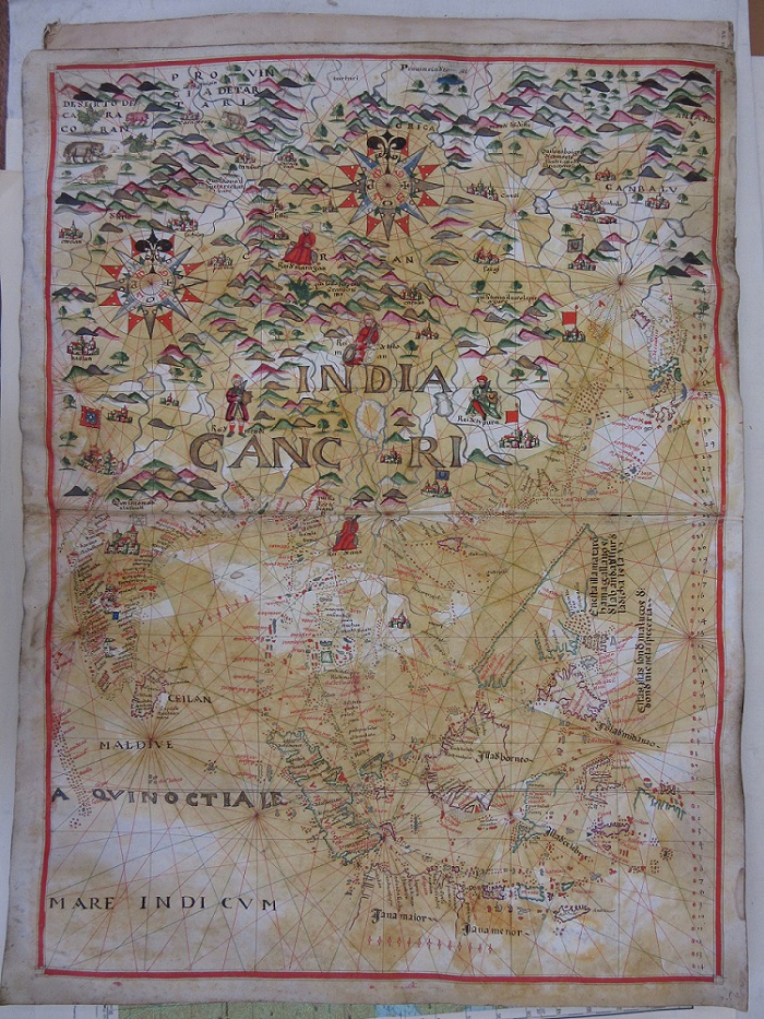
This image shows the islands of Indonesia and the Philippines and the coastlines of India and China and is richly decorated both in cartographic detail and local features. The map covering Africa shows the animals to be found on the continent, including the elephant

Portolan charts date from the mid to late thirteenth century and continued in use until printed navigation charts, including those published in great numbers by the Hydrographer to the Navy and held by the in the map collection at the Bodleian, replaced them. Often stitched onto cloth and rolled up these charts were used by navigators at sea. Rhumb lines radiate out from compass points allowing for readings to be taken and courses plotted.
This atlas is but one of the 19,000 items donated to the Library by the antiquary Francis Douce.
MS Douce 391. Circa 2nd half 16th century.