
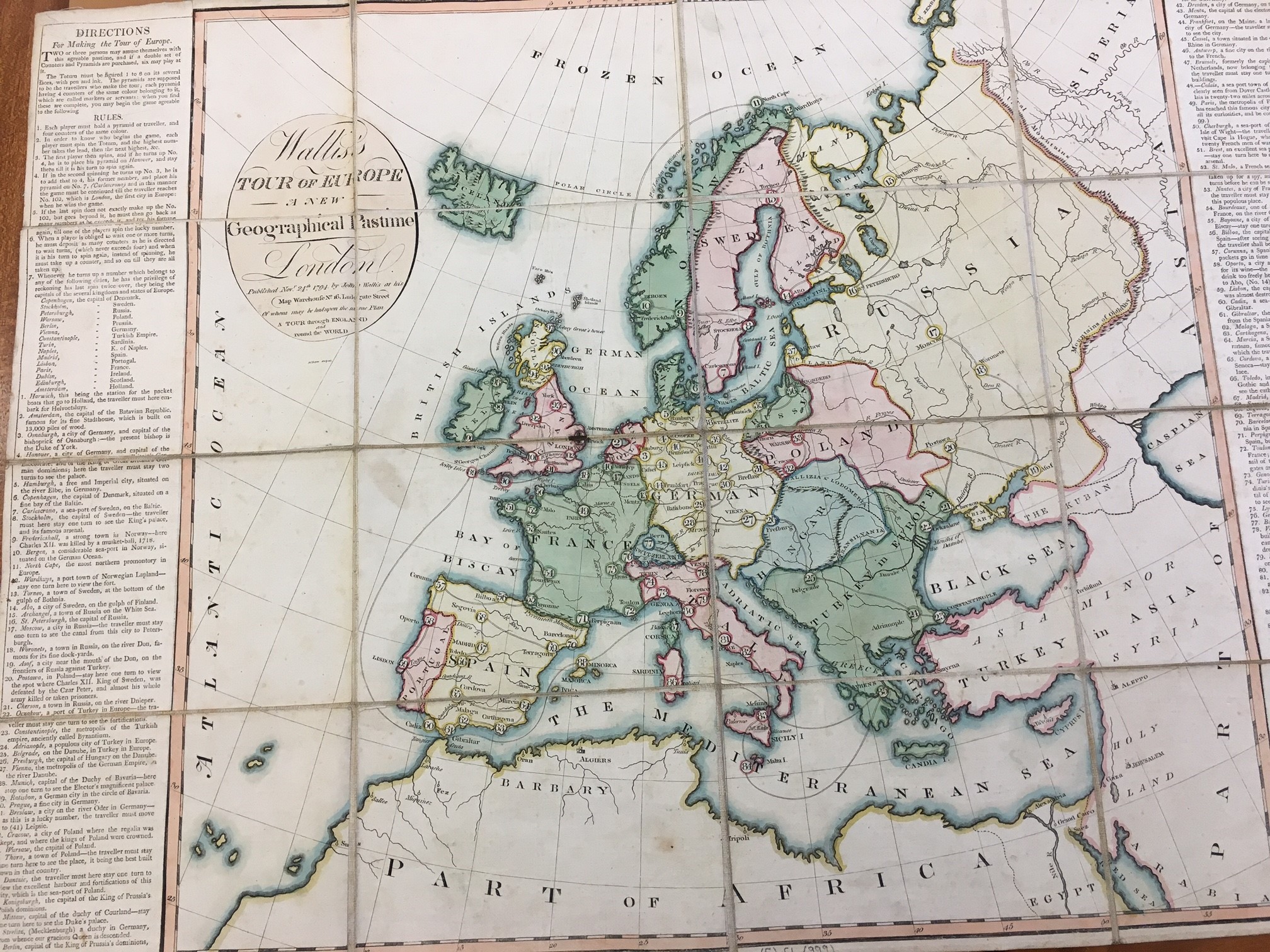
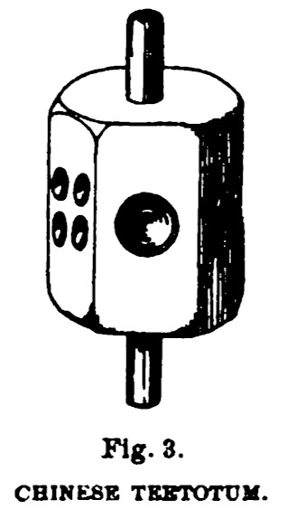
 No upper class young man worth his salt in the eighteenth century could hold his head up if he hadn’t traversed Europe on a Grand Tour. However, for the less fortunate help was at hand in the form of a cartographic race game. Wallis’s Tour of Europe. A New Geographical Pastime was published by John Wallis, a cartographer and map seller in 1794. “Two or three persons may amuse themselves with this agreeable pastime, and if a double set of Counters and Pyramids, six may play at it”. Players use a spinning a ‘teetotum’, a sort of gambling spinning top counting up to 8, to progress as dice were considered gambling instruments thus inappropriate in Christian households.
All the players start at Harwich and the race moves across Europe along the numbered route. They journey from Amsterdam through Germany, Sweden, Norway, even Lapland, Russia, Turkey in Europe, France Italy, Spain and Portugal returning to England through Portsmouth then taking in Scotland and Ireland the winner finally finishing in London after 102 stops. Unlike the real thing the route takes in such places as Wordhuys (Vardo) in Finnmark, Norway, Woronets (Voronezh), Adrianople (Edirne) and Johny Groat’s House in Scotland along with the traditional Athens, Florence and Rome.
The panels on either side of the map detail not only the rules but also lists each stop with a brief description so players could ‘experience’ Europe though text. The players can become well-travelled without the need for a gap year and a fortune. Games like these were very popular in the eighteenth and nineteenth century in the parlours of middle class households to keep people entertained in the long evenings.
The map itself is a fairly simple hand coloured map with political boundaries and the mountain ranges drawn in pictorially. It is mounted and linen so can be folded neatly and put away when not in use.

Wallis’s Tour of Europe. A new geographical pastime. London, 1794 (E) C1 (999)