
This beautiful map of Nineveh is a sad remainder of the recent destruction caused by ISIS forces in the Northern Iraq area. For a time Nineveh was the greatest city in the World, capital of the Assyrian Empire, until its sacking in 612BC. Trade between the Mediterranean region and the East travelled along the Tigris River, bringing great wealth to the city.

As well as the threat posed by opposing forces fighting in and around Mosul the area is also down-river of the Mosul Dam, declared in 2006 to be the most unstable in the world. Mosul is situated on a major fault-line and any tectonic activity in the area, which has in the past caused damage to temples and buildings at Nineveh, could be disastrous.
The main part of Nineveh, the Koiyunjik mound, has been excavated a number of times since the mid-1800s. Remains of Palace buildings and temples have been found here but looting has
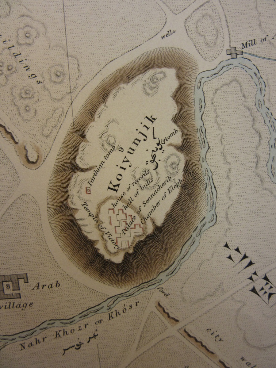
caused considerable damage to the site. Modern Mosul now spreads east beyond the historical site of Nineveh with suburbs between the two mounds of Koiyunjik and Nebbi Yunus. As of the 9th of January the ruins of Nineveh were on the front-line of territory held by ISIS and the Iraqi Army.
The map is published by the East India Company, which up until a few years after the date of the map controlled large parts of the sub-continent. Given a Royal Charter to trade with India in 1600 the company subdued large parts of the country and it was only with an act of Parliament in 1858 following rebellion in 1857 that the British Government, in the form of the Raj, took over control.
 Vestiges of Assyria, sketch 1st, an ichnographic sketch of the remains of
  ancient Nineveh, with the enceinte of the modern Mosul…constructed from trigonometrical survey in the spring of 1852 at the command of the Government of India by Felix Jones… Published by John Walker, Geographer to the Honble East India Company, Feb 2nd 1855. D19:30 Ninevah (1)