
This beautiful map, ‘A plan of the situation of the ancient borough of Haslemere in the county of Surrey…’ is a colourful and detailed example of a cadastral plan, a map designed to show individual buildings and ownership.
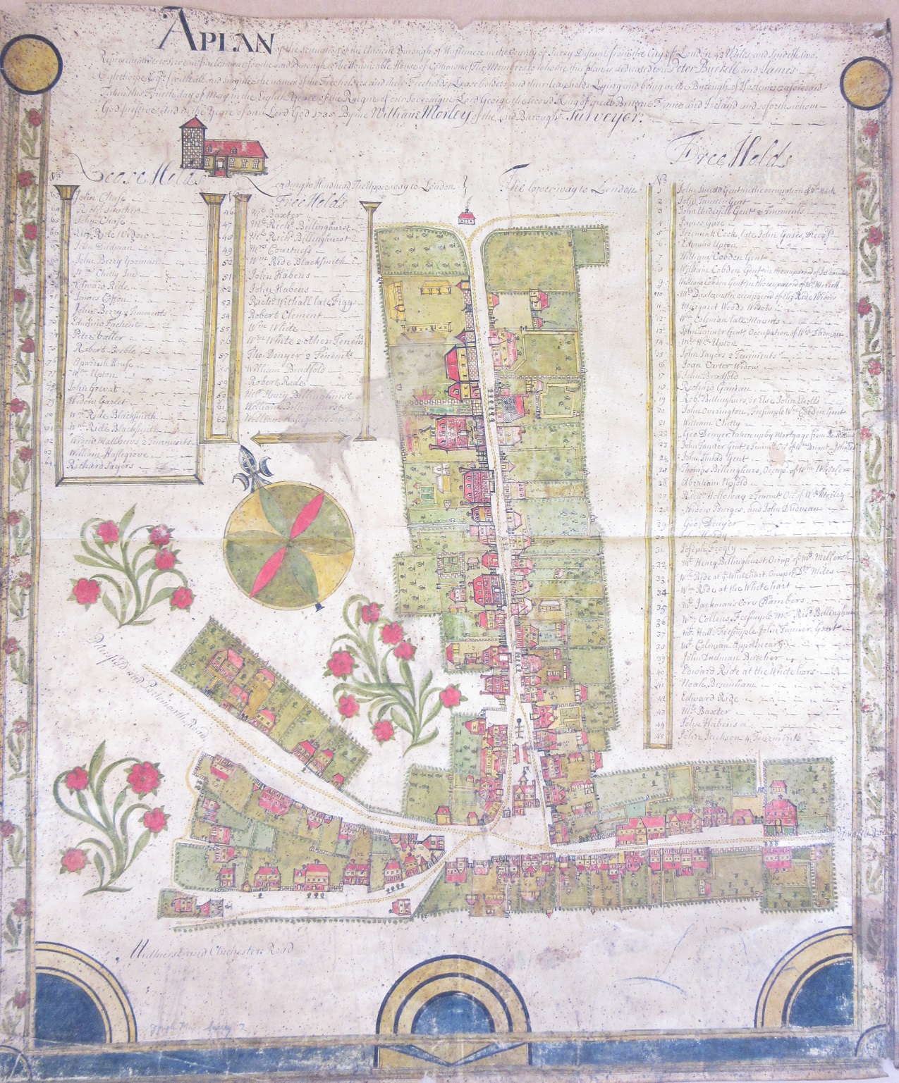
The map shows what is now the High Street in the town. Listed either side of the plan are the lease and free holds with the houses numbered and occupants listed. The biggest house, nu 2, belonged to John Tanner, Gentleman.

John Tanner’s house, number 2. Staining and black dots evident in this close-up.
Drawn onto vellum in 1735 the map is showing signs of damage. The map has holes in the corners, suggesting that at some point it was pinned to a wall, and there is a strip of paper on the reverse running along the middle, an indication that it has also been stuck into a book. This doesn’t detract from the attractiveness of the map though. Similar in design and purpose to Estate maps the cartographer William Morley has richly decorated both the houses and the borders with the compass rose and flowers, as well as the columns and edge decorations.
The map comes from the Gough collection, one of the most important of all the donated collections to the Bodleian. Richard Gough was a noted antiquarian who collected topographical prints, drawings and related items. Included in his collection, which came to the Bodleian after his death in 1809 are the Gough Map (http://www.goughmap.org/map/) and the Sheldon Tapestries. Almost all the maps from the Gough collection are black and white, making this beautiful plan of Haslemere stand out.
A plan of the situation of the ancient borough of Haslemere in the county of Surrey, 1735. Gough Maps Surrey 7
Pingback: A plan of Haslemere, 1735 – GeoNe.ws