
 The National Encyclopædia Atlas is a beautiful example of a mid-Victorian atlas. Published in 1868 and intended for both home and school the book features maps of the major countries of the World as well as a short introduction with a number of World maps. Using the double hemisphere method the atlas has two different World views, both thematic. The first has a physical map showing mountain chains, river systems, trade winds and ocean basins, with views of the Northern and Southern Hemispheres and Land and Water Hemispheres. Double Hemisphere representation is a long-established way of portraying World maps, though the changing of the positioning of the poles to highlight a side of the Earth more land or water based is an unusual feature.

Physical Map of the World, from The National Encyclopædia Atlas
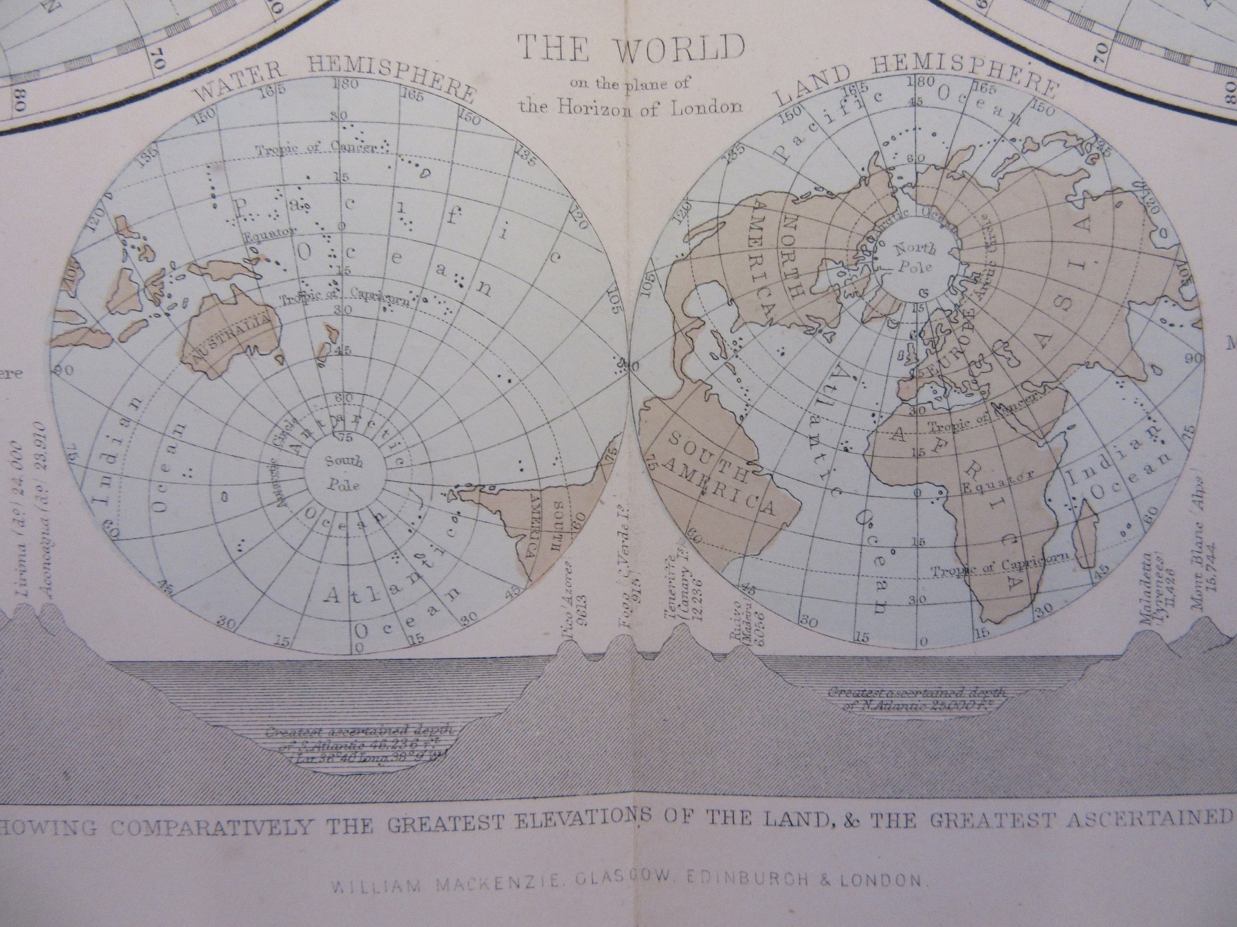
Directly underneath the two hemispheres is a strip showing mountain profiles, describing itself as a ‘Imaginary section showing comparatively the greatest elevations of the land & the greatest ascertained depression of the sea’. Mountains feature on the next page, with the highest in the Western and Eastern Hemispheres at left and right and river systems going from top to bottom.


The highest mountain in the Eastern Hemisphere, on the right, is of course Mount Everest, which at the time of the atlas was measured at 29,002 feet (it is now measured at 29,029). Just above is a balloon labelled Green. Charles Green was a celebrated balloonist who in 1838 rose to 27,146 feet in an ascent which saw temperatures drop to as low as -27°.
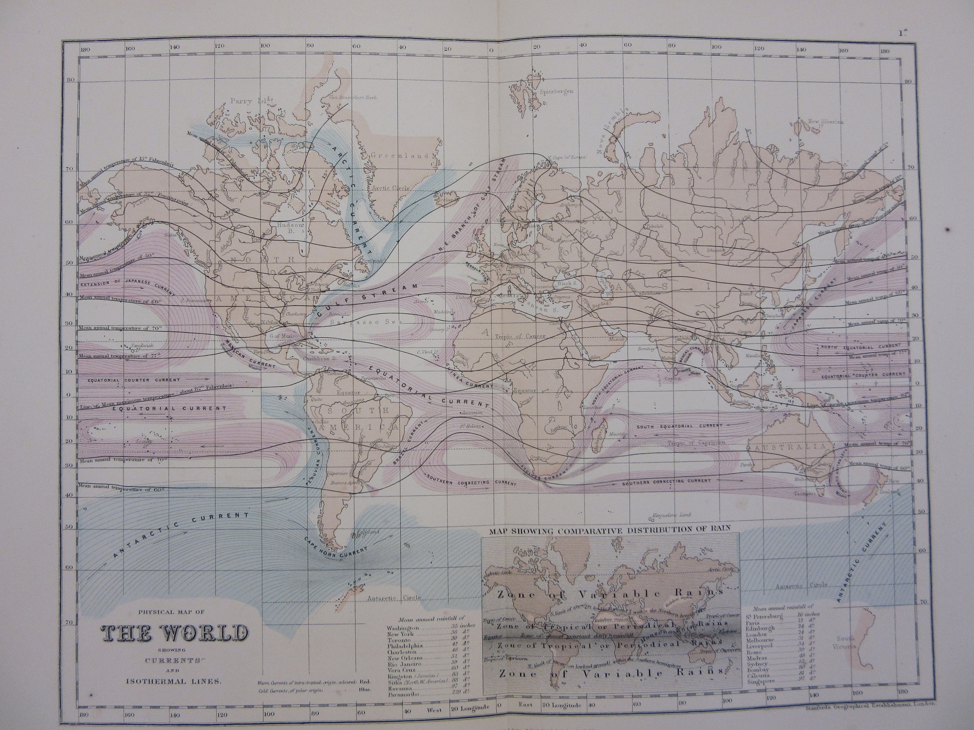
The second World Hemisphere map in the atlas shows ocean currents and isothermal lines (now called isotherms), as well as a small inset showing the comparative distribution of rain. Isothermals are lines showing areas where the temperature of air or sea are the same and is a term first used by the naturalist Alexander von Humboldt during his study of plant distribution throughout the World. Ocean currents are beautifully depicted in graceful pink curves and the map graphically shows the Gulf Stream and the Arctic Currents which have such an effect on the weather patterns and temperatures of Great Britain and the East Coast of the United States.
The National Encylopædia Atlas, 1868, published by William Mackenzie. 3.Δ 1326
Pingback: Maps for the Aironauts…engravings by the best masters | Bodleian Map Room Blog
Pingback: The National Encyclopædia Atlas – GeoNe.ws