
The Ordnance Survey have been producing maps since the early 1800s when the first in a long sequence at 1″ to a mile was produced in preparation for a possible invasion by the French Revolutionary armies. Four sheets were published covering South East England. Over years these maps, through changes in production, design and conversion from imperial to metric have morphed into the 1:50,000 Landranger maps we buy now.
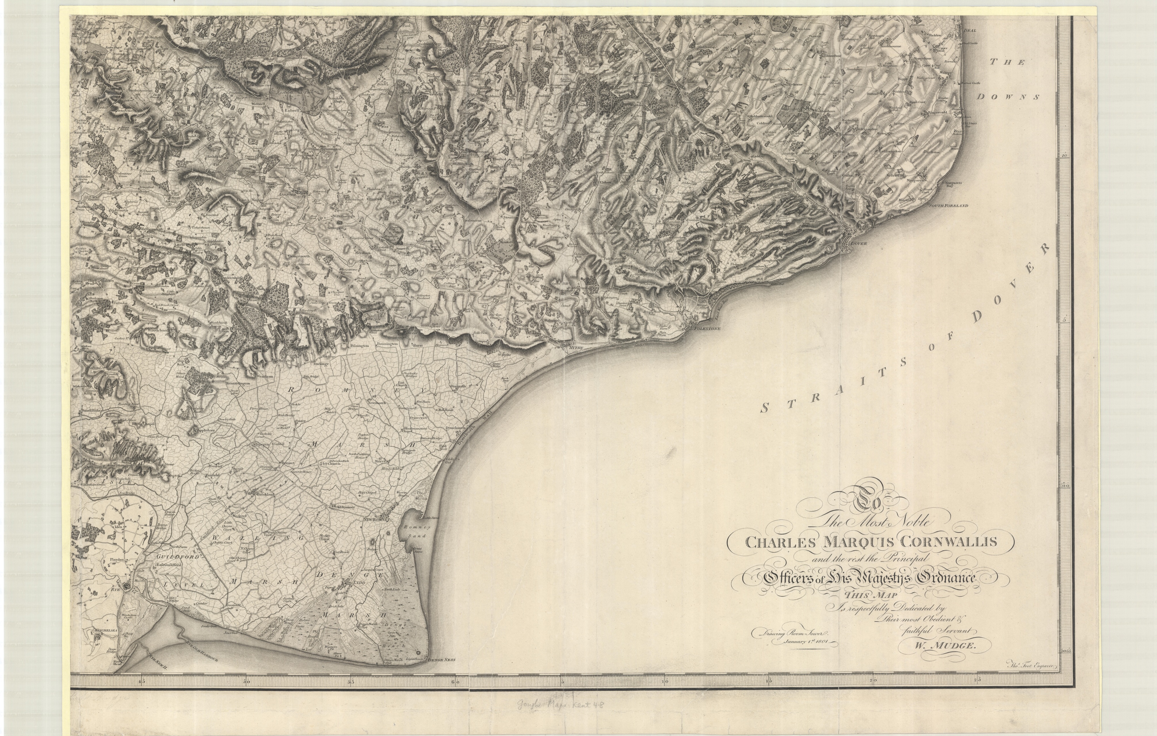
Bottom right sheet of ‘General Survey of England and Wales…’ Ordnance Survey, 1801. Lawn c. 163
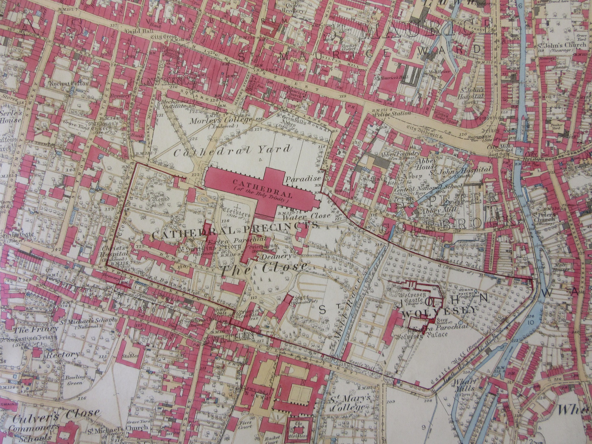
Lesser known than the maps we buy in shops are the detailed large scale mapping that have been produced since the middle of the Nineteenth Century and are now available digitally within the library (contact maps@bodleian.ox.ac.uk for more information). Maps at 1:2,500 scale (25″ to a mile) cover almost all the country (moorland with no habitation wasn’t covered) at such detail that individual buildings and many trees can be shown and the amount of social as well as topographic information is comprehensive. Thousands of sheets were published, and there were in most cases at least 3 editions leading up to the end of the Second World War. This series of mapping included Wales, Scotland and Ireland as well as England. The first edition was available both coloured and un-coloured. As well as a marvellous resource for study the coloured sheets are also beautiful, as this extract of Winchester cathedral shows.
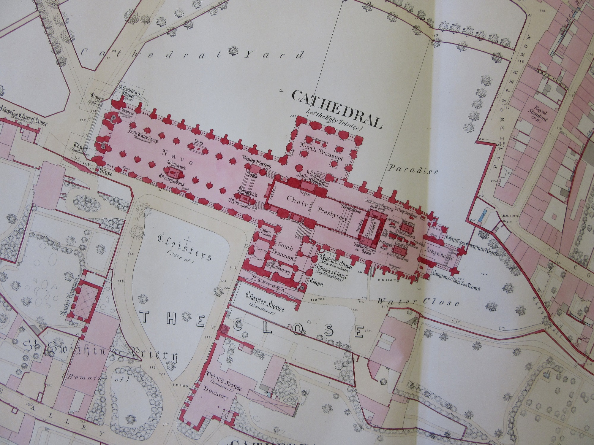
At the same time that the 1:2,500 series was surveyed and produced major urban towns and cities with a population above 4,000 were published at an even greater scale, 1:500. At 126″ to a mile extra space allows for not only much more detail but also the insides of the most important buildings to be shown, so Winchester Cathedral, shown above at a lesser scale within the precinct and the surrounding buildings suddenly opens up like this
Most of the town plans in the Bodleian, including Oxford, are in black and white. A few, such as Winchester here, were hand coloured. There are 27 sheets covering Winchester at this scale, and the amount of infrastructure, and hence the amount of hand-colouring on each, determines the cost. The cheapest were sold for 2 shillings a sheet while the most expensive went for 8 shillings. The Cathedral sheet sold for 7 shillings.
This image of Winchester Cathedral comes from the unusually titled ‘Map of the County of Southampton from and actual survey made in the years 1825 & 1826 by C & I. Greenwood’.

(E) C17:32 (78)
Pingback: Pretty in pink – GeoNe.ws