
Maps come in all sorts of shapes and sizes and one recent purchase by the Rare Books Section was not one I’d seen before. The artist’s book The last voyage by Tracey Bush 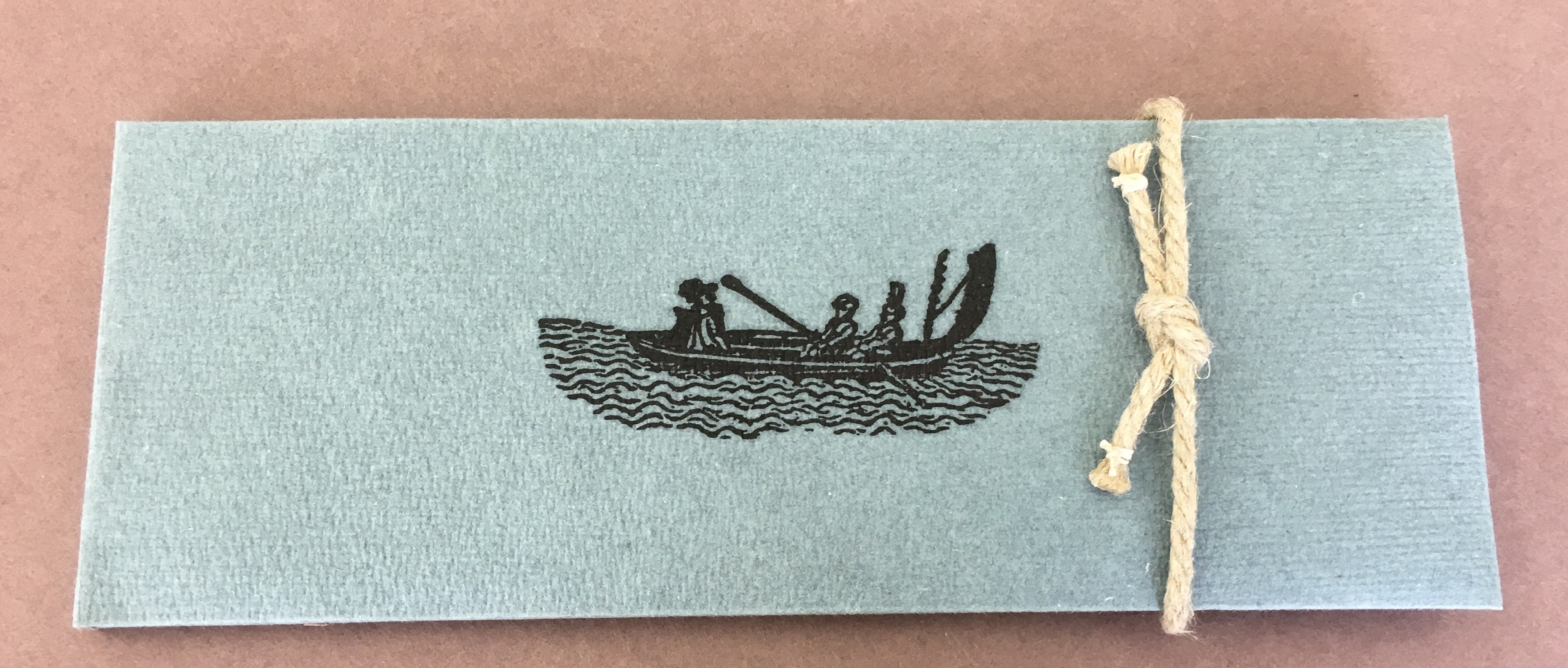 is based on a poem by a seventeenth century wit John Taylor who undertook a journey in a paper boat with two stockfish tied to canes for oars from London to Queenborough on the Isle of Sheppey in Kent. The map is fashioned into a hand folded paper model of a boat which is accompanied by a booklet with extracts of the poem In praise of the hemp-seed written by Taylor to describe his journey. The booklet and boat are made entirely by hemp paper and are contained in a folder secured by a small piece of hemp rope.
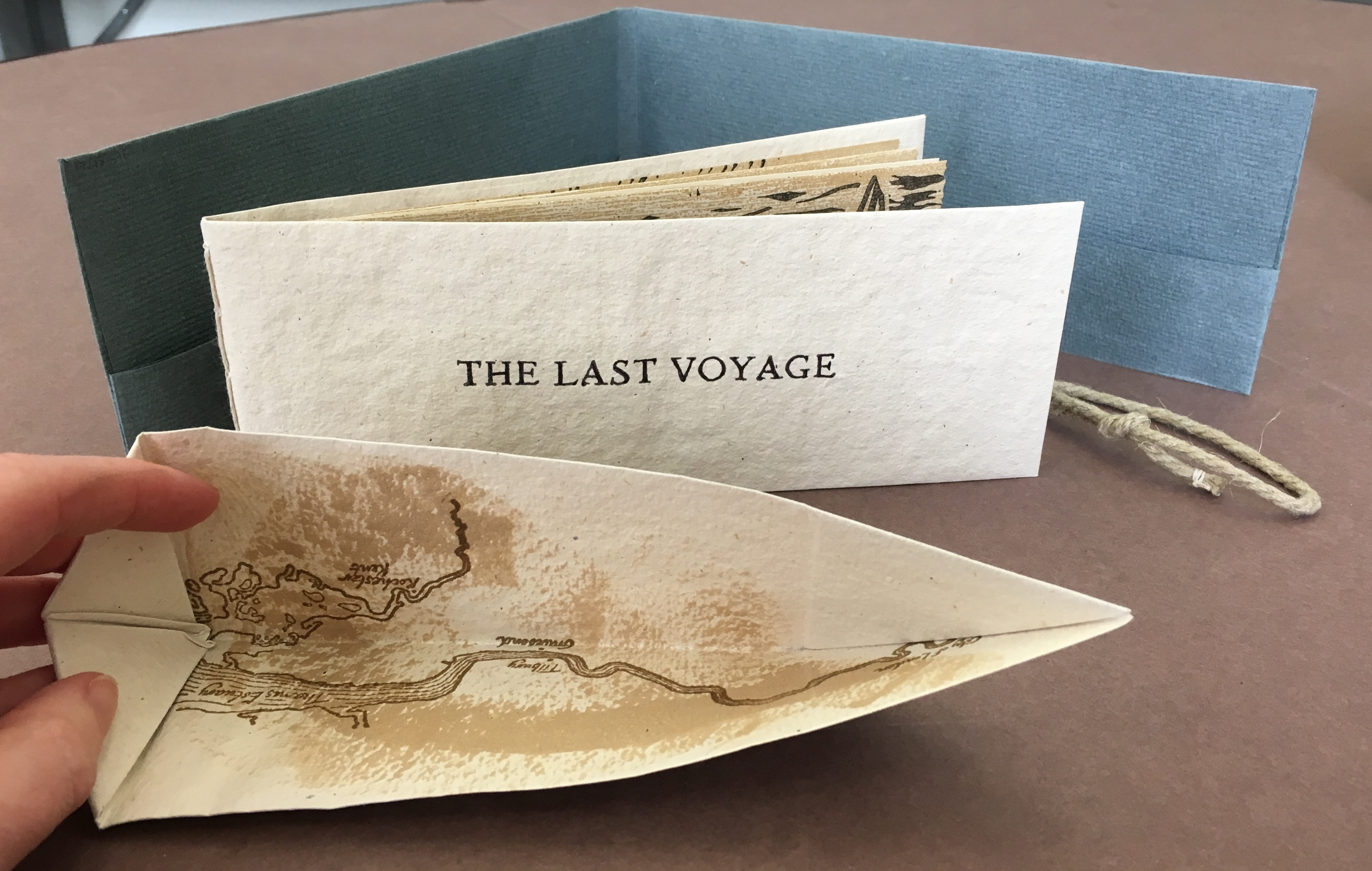
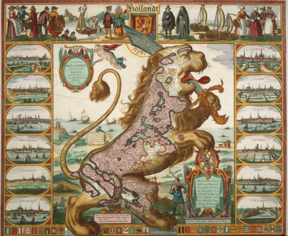
This artistic use of maps is increasing with the popularity of maps as visual objects and you can see them everywhere – mugs, mouse mats and even the former First Lady’s dress. What is it about maps that is so appealing? Is it the potential for a journey? The depiction of something (generally) real? Or do they just make pretty things to look at? Whatever the draw it has been going on for centuries as can be seen by Leo Belgicus which was first drawn in 1583 by Michaël Eytzinger, an Austrian cartographer. He depicted the Low Countries as a lion rampant facing east, an image which was popular in various forms for many years.
As was closer to home James Gillray’s caricature of England as an old woman seated on a sea creature. Otherwise it is the content, rather than the appearance of the map which is more important – who hasn’t seen advertisements for items personalised with a map of a significant location in cufflinks, necklaces and puzzles.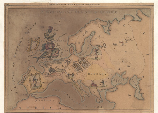
Whatever it is in this age of technology maps remain relevant as practical items (an Ordnance Sheet doesn’t require a mobile phone signal) and an artefact thus still fulfilling the Encyclopaedia Britannica’s definition of cartography as ‘the art and science of graphically representing a geographical area, usually on a flat surface such as a map or chart. It may involve the superimposition of political, cultural, or other non-geographical divisions onto the representation of a geographical area.’
Pingback: Boats and Maps – GeoNe.ws