
Two early maps of New Zealand, both from the 1840s, which use different names for the three islands. Polynesian settlement dates from around 900, with Abel Tasman being the first European to see the islands in 1642. The Dutch named the islands Nova Zeelandia after the province of Zeeland in 1645 which was then anglicised by Capt. James Cook in 1770.
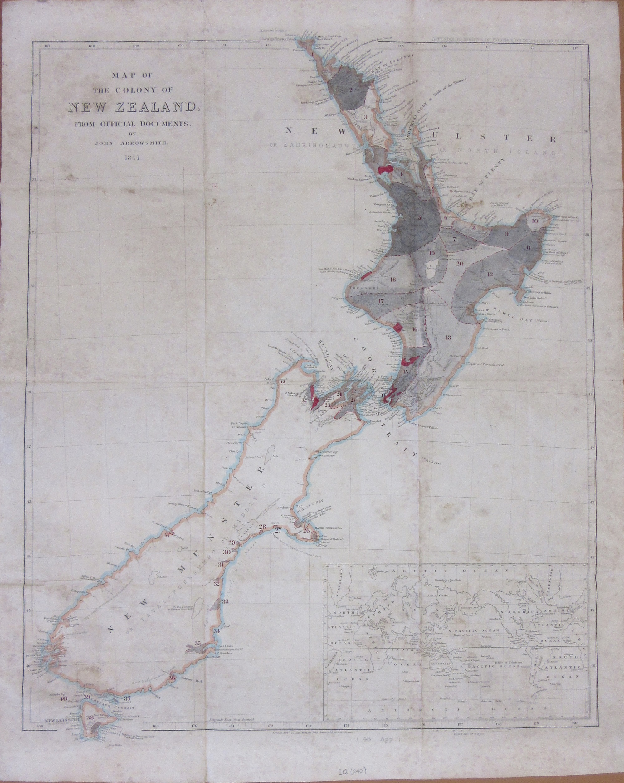
This first map is by the cartographer John Arrowsmith in 1844. Map of the Colony of New Zealand from official documents by John Arrowsmith and shows how, just 4 years after the Treaty of Waitangi signed between the British and Maori recognizing British sovereignty over the islands the land was already being allocated to European settlement. The islands have unfamiliar names; New Ulster, Munster and Leinster suggesting a strong Irish settlement but in fact come from a new Constitution of Government sent from London in 1846 to replace an earlier unpopular one. The Islands were to be divided into two provinces, Ulster and Munster, with two Governors. Bizarrely the Islands weren’t intended to be split between North and South but on the line of the River Patea, in the North Island, with everywhere north of this to be New Ulster, everywhere south to be New Munster. There was no mention in the new constitution as to why these names were chosen. Arrowsmiths map of 1844 seems to be a reprint of an earlier map from 1841 with additional land ownership information. Arrowsmith produced maps of New Zealand at this time for official Government reports, and it is likely that this map accompanied a select Committee report on New Zealand from 1844.
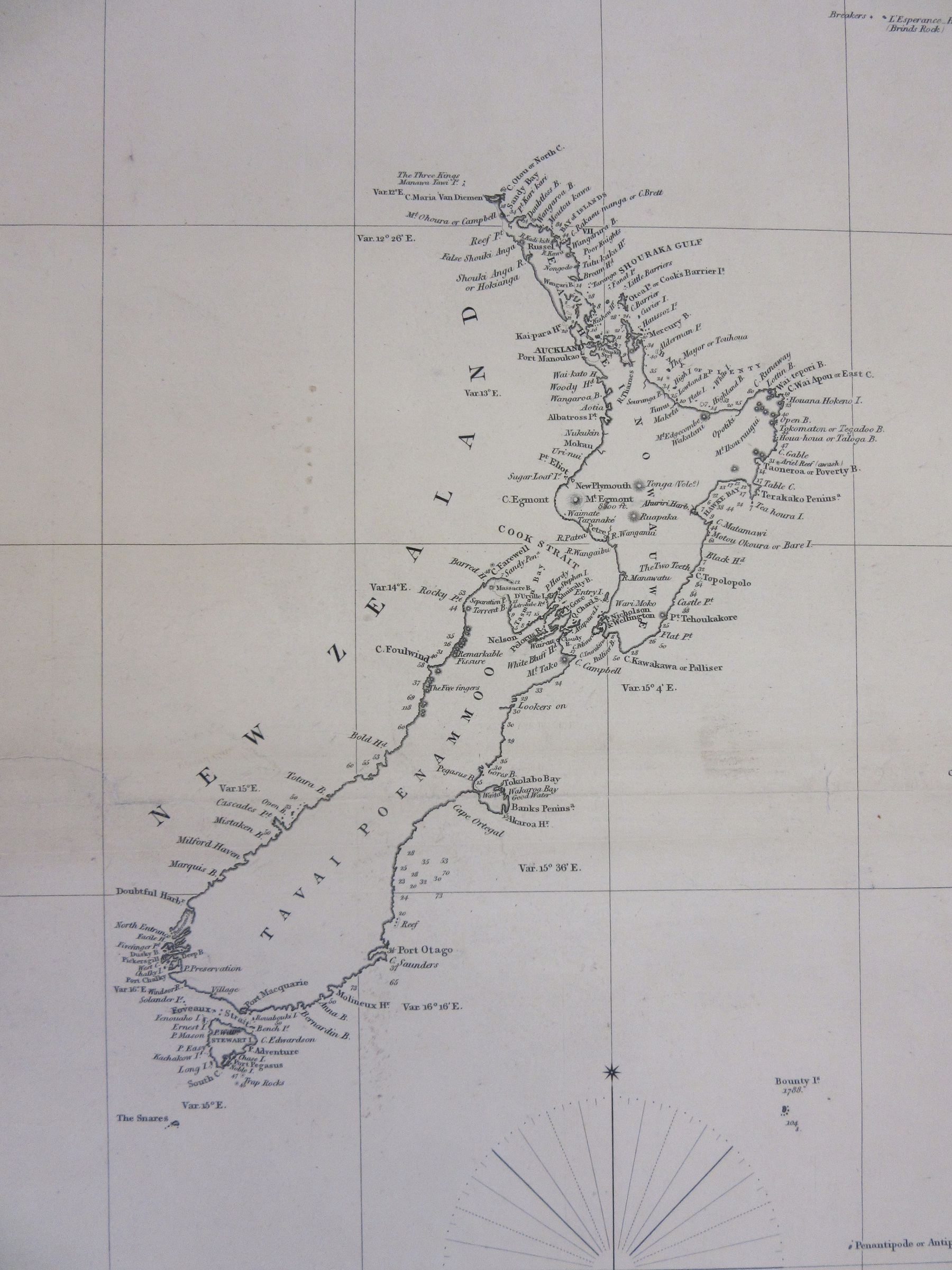
This second map, an extract from New Zealand and Oceanic Islands, dates from 1847 and uses Maori names for the two large islands.
The third map is a strange one for a number of reasons.
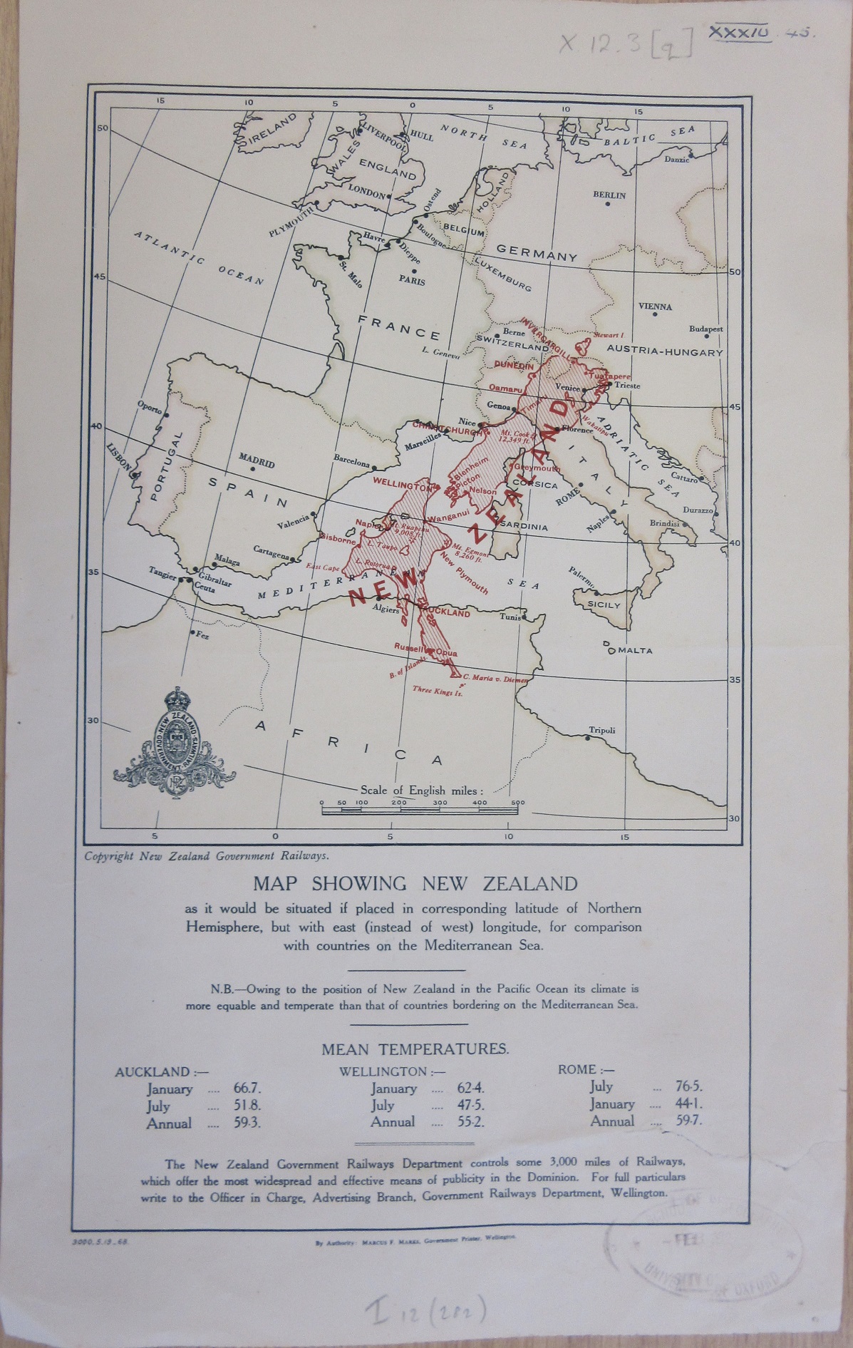
The map, Map showing New Zealand as it would be situated if placed in corresponding latitude of Northern Hemisphere, but with east (instead of west) longitude, for comparison with countries on the Mediterranean Sea dates from 1968 but places New Zealand over a pre-World War One map of Europe (note the existence of the Austro-Hungarian Empire and pre-war Germany) but in trying to encourage emigration into the country by suggesting temperatures are similar to favourable European countries the text isn’t entirely honest. Auckland’s mean temperatures are compared to Rome despite being closer to Algiers and doesn’t include anywhere on the colder South island.
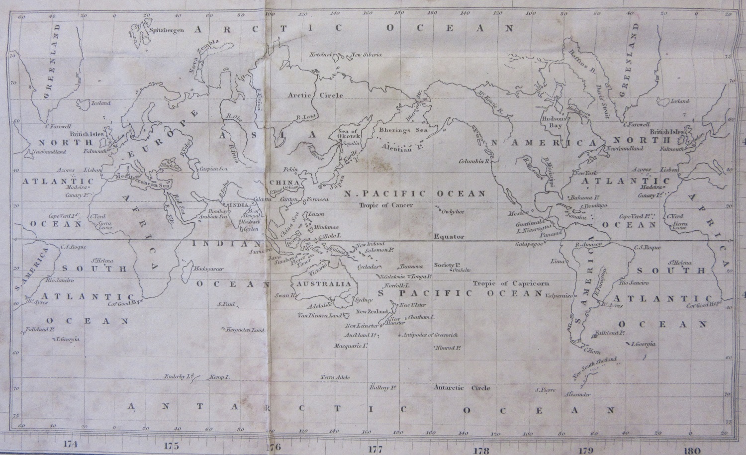
Finally an inset from the 1844 Arrowsmith map showing a World map with New Zealand in the middle.
Pingback: Maps to justify your existence | Bodleian Map Room Blog
Pingback: Early maps of New Zealand – GeoNe.ws