The contrast between these two maps is striking, considering they are both the same.

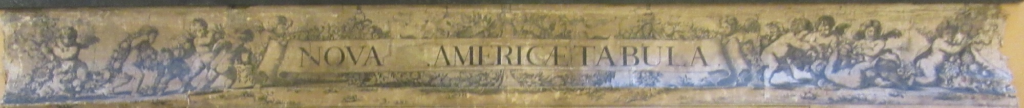
The Bodleian has two copies of South America corrected from the observations comunicated to the Royal Society’s of London & Paris… by John Senex, and dating from 1710. The copy on the right is a single sheet which has been folded and then incorporated into an atlas of maps by Senex soon after printing. As can be seen from the image the colours are strong and there is no damage or staining on the sheet.

The copy on the left has just come into the library as part of a large donation of rolls. To protect rolled maps from damage they were often attached to a linen backing and then varnished, hence the frayed and stained appearance of the map. It is now hard to see too much detail on the map compared to its cleaner cousin.

This map has also had additional strips added to the sides and top, with the new title (at top of this blog) and then text on either side about the continent.
The unvarnished map has a beautiful cartouche, which as well as giving title and printing details also gives

an idea of a European viewpoint of South America, with an Amazonian warrior, decapitated  head and cannibal feasts in the background. The warrior is a common symbol of America and is always shown with a bow and arrow and a crocodile. Just above is a representation of a Penguin, with descriptive text stating ‘In this icy sea there are many animals which are half fish, half fowl. They have a neck like a swan which they often thrust above water for air, the rest is allways under water’. To the right of the penguin is the inscription ‘ Here Cap. Halley found the sea full of ice’. In 1699 Edmund Halley, astronomer and mathematician, sailed on the Paramore across the Atlantic to carry on experiments on mapping the magnetic currents and flows of the World as well as mapping the Southern Hemisphere constellations and stars. On his return to England in 1700 he published the first magnetic declination chart of the World and then in 1703 he was appointed Savilian Professor of geometry at Oxford University. The map, made by John Senex, is dedicated to Halley. Senex was a prolific publisher of maps and atlases and was at one time cartographer to Queen Anne. He was elected to the Royal Society in 1728 and when he died in 1740 his wife Mary continued his work.

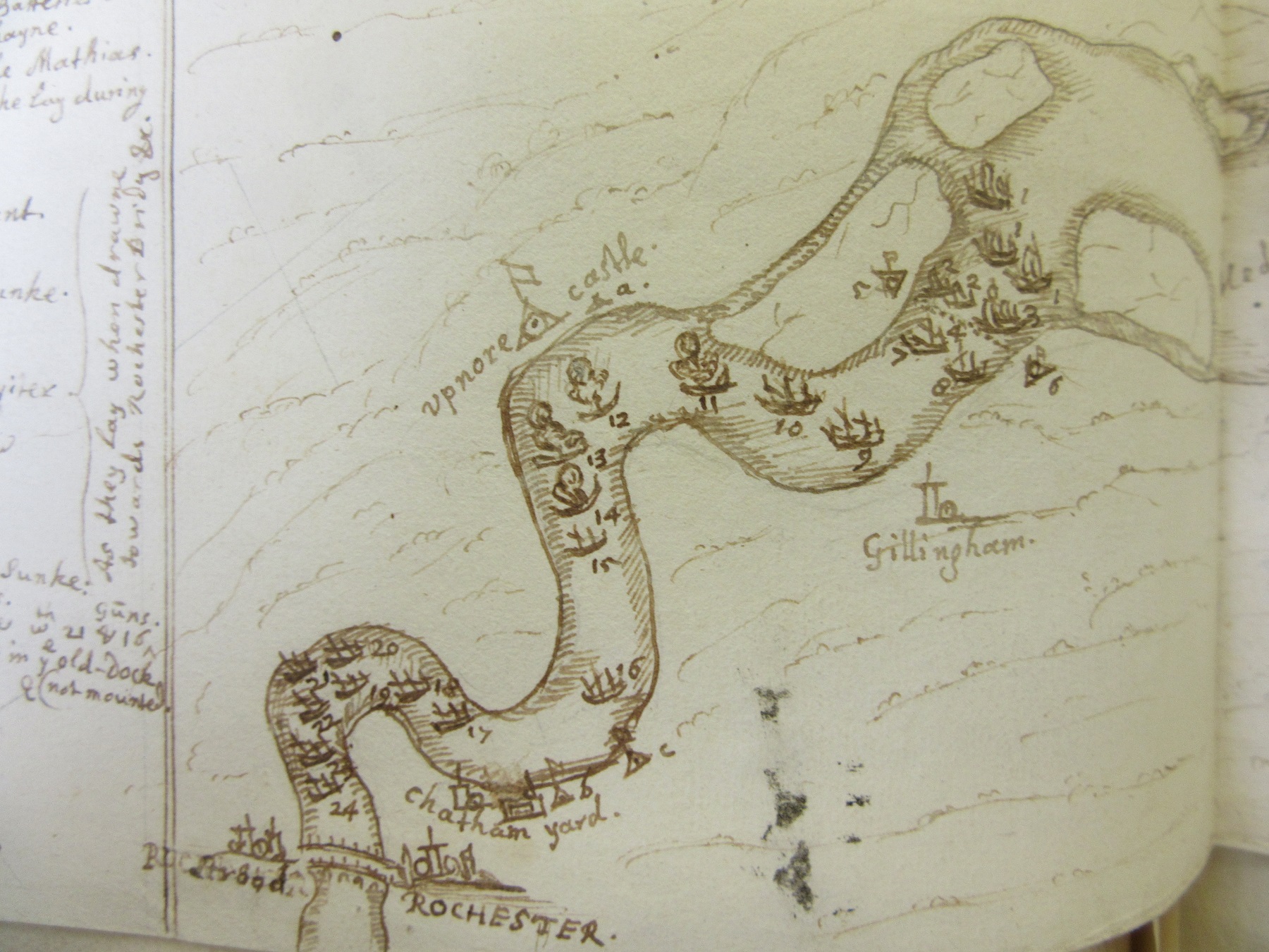
The Atlantic has been overly blessed with places that either never existed or have changed names completely. Pepys Island is one of the more celebrated of the ‘phantom islands’ of the Atlantic. Pirates in 1684 sailed close to the Sebald de Weerts Islands and marked this in the ships journal. Later this was heavily rewritten and published by someone keen to gain the favour of the Secretary of the Navy, Samuel Pepys, and named a new island after Pepys despite the original journal stating the island was part of the de Weerts group. Pepys Island went on to feature in numerous maps up until the mid-1800s. The Sebald de Weerts islands are now known as the Jason Islands. Just as strange is the naming of the southern part of the Atlantic as the Ethiopic Ocean, a name which dates back to classical times when most of Africa south and west of Egypt was called Aethiopia.
South America corrected from the observations comunicated to the Royal Society’s of London & Paris… by John Senex, 1710. Allen 15a.