The map collection at the Bodleian is arranged by area, and identified by letters and numbers. A is for maps of the Universe, B the World and so on down to N which is for the Antarctic. Further subdivisions within these letters give you individual countries, so for instance England is C17 (the C is for Europe). The system doesn’t end at N though, for there is one further section full of maps which either are of places that don’t exist or are cartographic items without a map on.
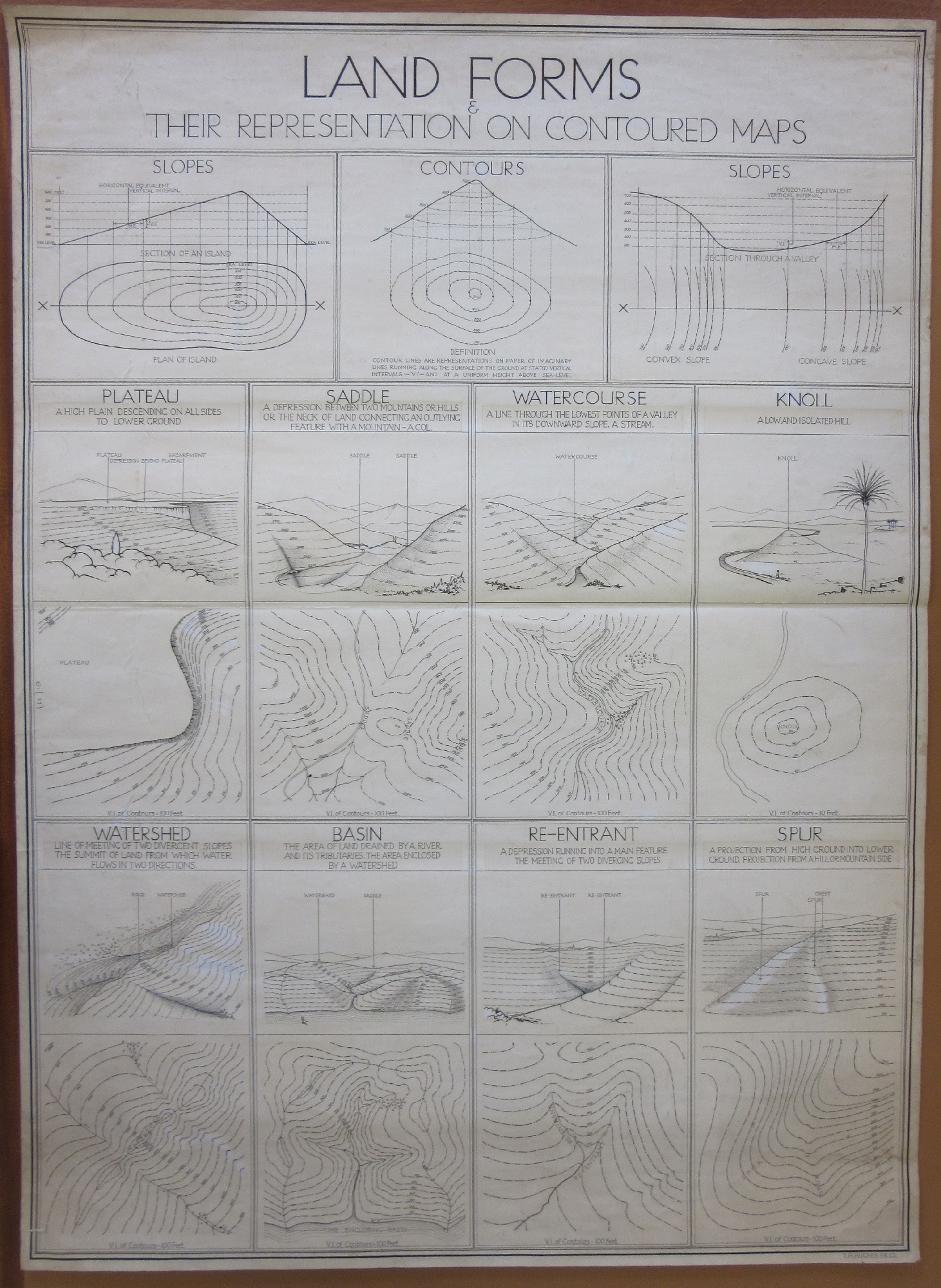
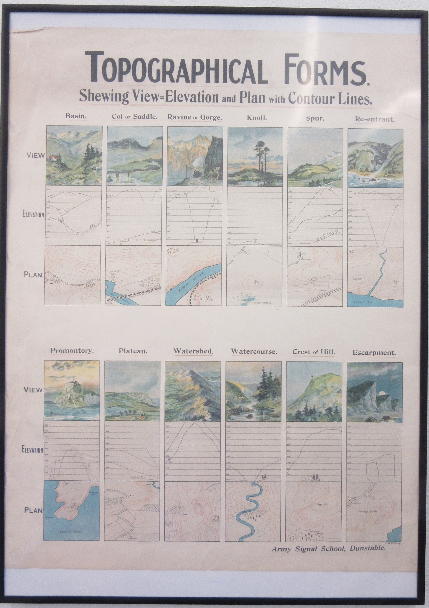
This is the O section. Included in O are maps of Middle Earth and Narnia, of Ambridge and the Island of Sodor (the Archers and Thomas the tank Engine respectively, in case you were wondering). There are also instructional diagrams for drawing maps. Neither have maps on but both have a simple beauty to them, and hark back to an age of plane-table surveying and pencil and paper work.This first example (Land forms & their representation on contoured maps, c1970, O1 (33)) gives examples of different types of profiles and land forms with accompanying examples of how these forms would be reproduced on maps with contours. This map is part of the general collection, the second example is in a frame and hangs on the wall in the Map Office. While the first example shown hasn’t any publishing details apart from the name ‘T.H. Hughes, F.R.G.S.’ in the corner the second example is published by the Army Signal School, in Dunstable, and would have been used as a teaching aid for training Military cartographers.
The School was at Dunstable for a brief period from 1916 until just after the end of the First World War. The Bodleian also has cartographic training manuals for the Austrian and German Armies.


Pingback: An idealised landscape and a common mistake | Bodleian Map Room Blog
Pingback: Not a #map – GeoNe.ws