
A box of donations is being cleaned and catalogued in the map office. The box is full of plastic relief maps, including this lovely map (model? mould?) of Bulgaria by the Bulgarian Telecommunications Company in a post-Soviet era 1993, shown complete

and in extract.
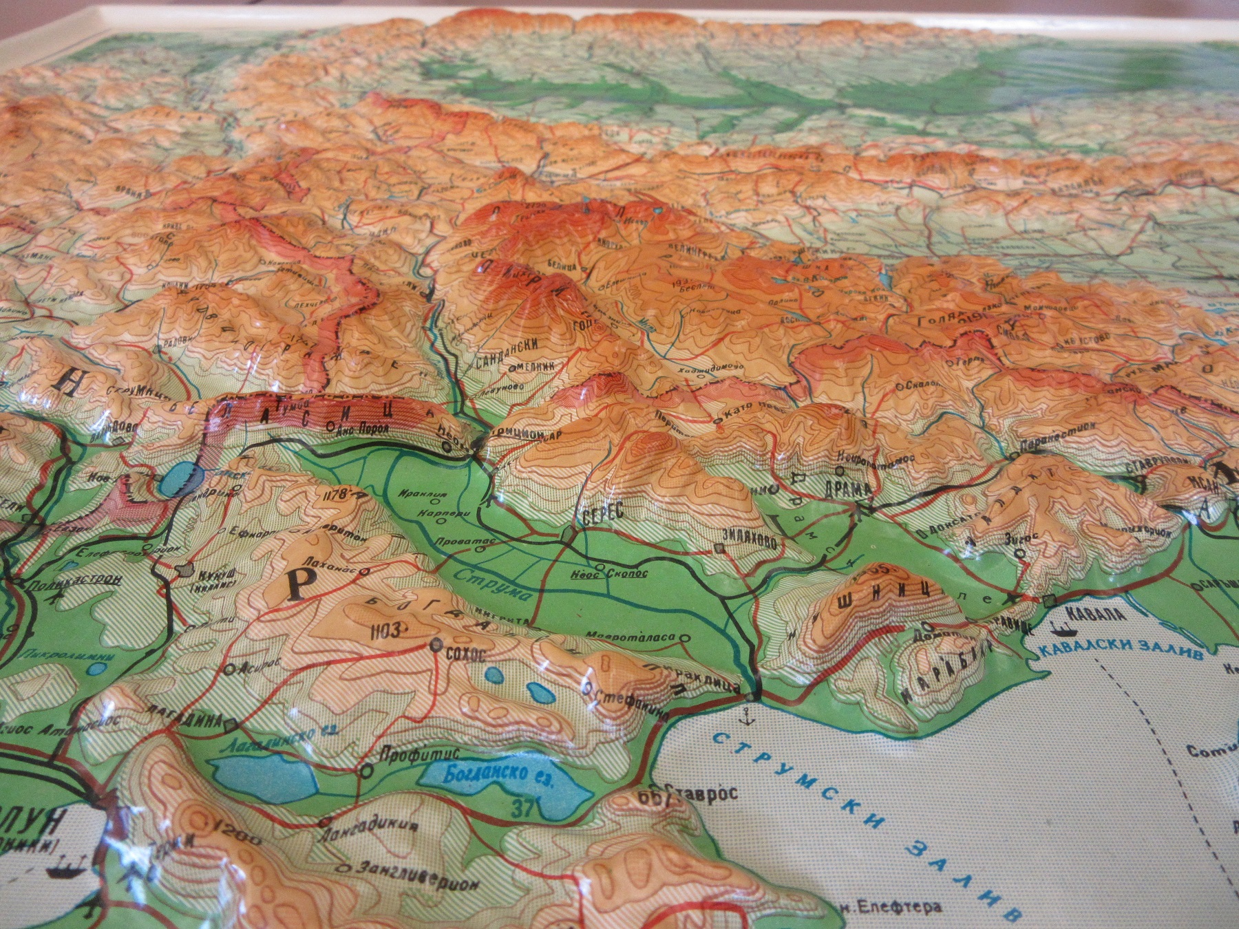
Republika Bŭlgariya, 1993. SP 101
What is interesting about this and the other relief maps in the box is they give both a horizontal and vertical scale ( in this case 1:1,000,000 for the normal, and then 1:150,000 for the up and down).
Not quite so attractivebut certainly more intriguing is this map by the United States Defense Mapping Agency Topographic Center of a Geoid World.

Geoid model of the World, 1972. SP 99
A geoid map shows the state of the World as if the oceans and seas covering the Planet were only under the influence of gravity and the Earths rotation, not tides or the planetary influence of the Sun and Moon. This, as can be seen on the map, would result in an uneven water surface over the globe, as the gravitational pull is stronger or weaker in certain parts of the World (the gravitational anomaly) the water surface would rise or fall accordingly. The information is mapped as if the whole of the Earth was covered in water.

The high and low water table is measured in 5 and 10 metre contours while, like the Bulgaria map above, the scale is given as both a normal (1:40,000,000) and vertical (1:19,000) figure.
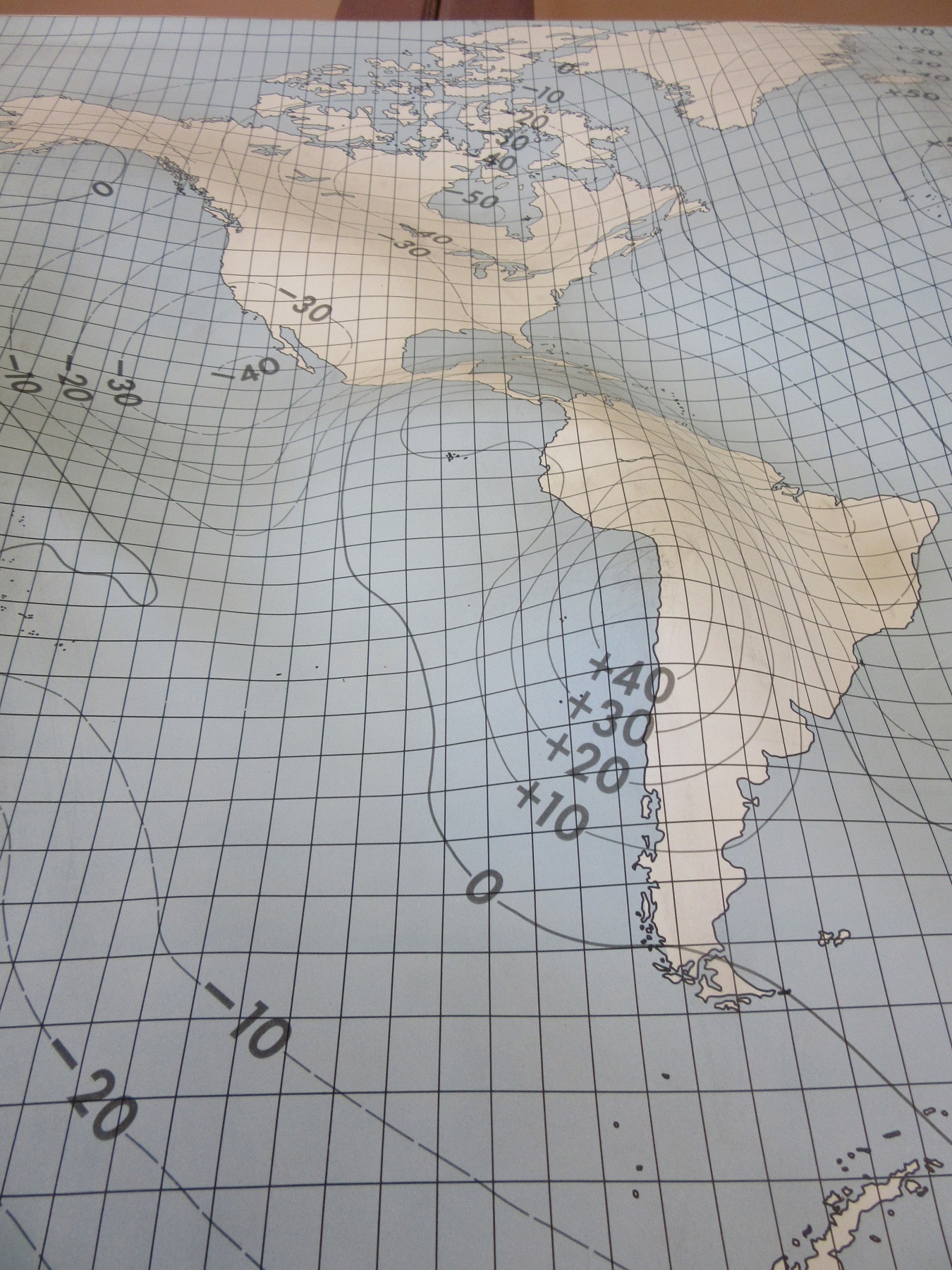
Knowing the geoid surface of the Earth is important in understanding ocean circulation and currents, with this information shipping routes can be plotted to use less fuel and shorten journeys.
To see an earlier blog on plastic reliefs held at the Bodleian go to January 2019 at the right of this page.