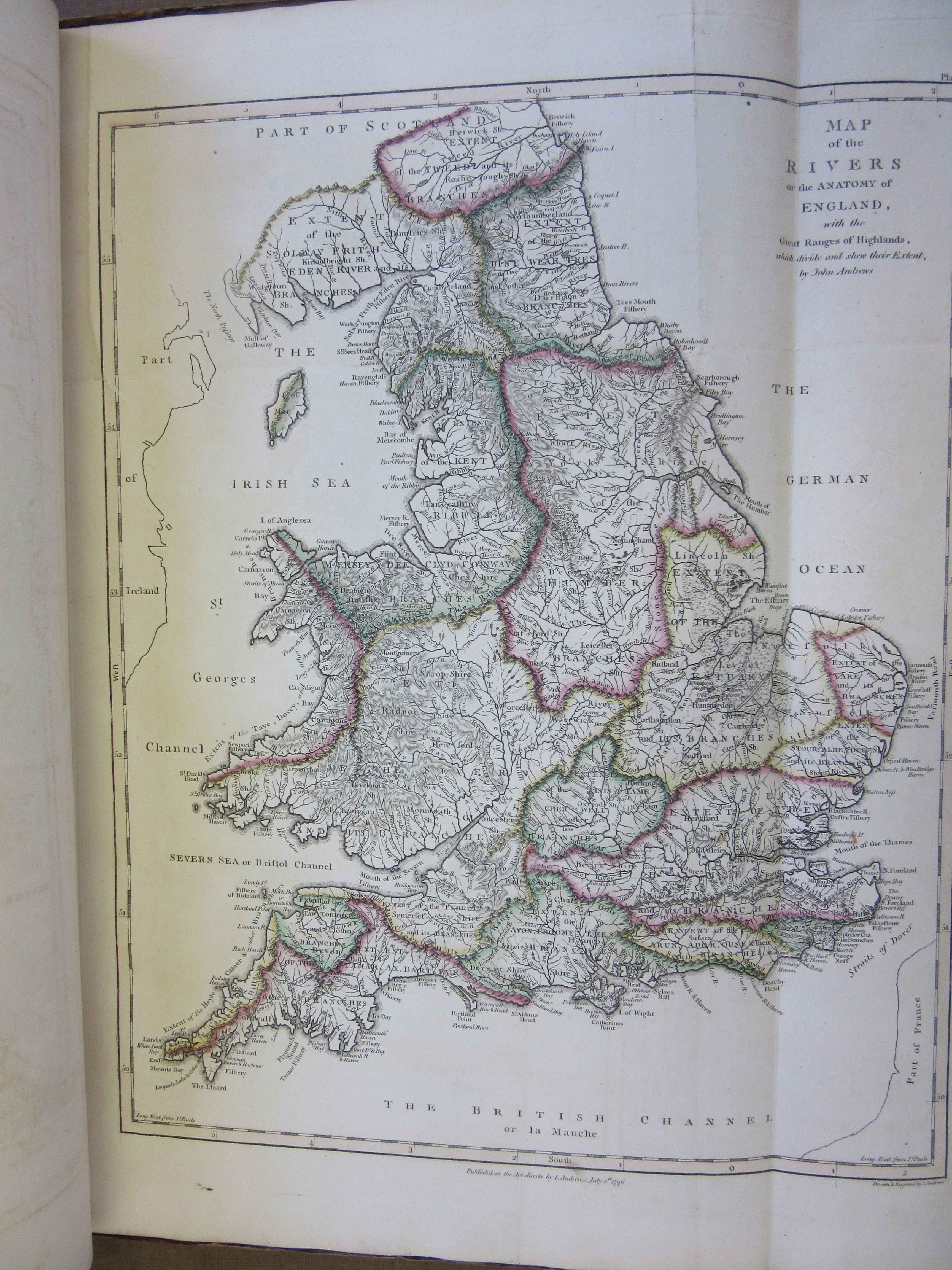
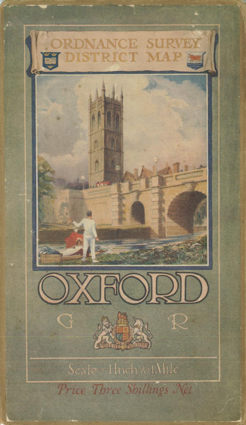
This first map from John Andrews’ A geographical atlas of England, divided according to its natural, political, civil, ecclesiastical, ancient and modern divisions … is at first glance hardly recognisable as a map of England and Wales. It shows only the mountain ranges, and the coastlines are missing. The next map in the atlas is described as a “Map of the rivers, or anatomy of England”; it is coloured to show watersheds, and again divides the country in an unfamiliar way. It is almost as if the first map shows the country’s skeleton, and the second the circulatory system.
The (very long) title ends with the statement that the atlas is ‘for the improvement of youth‘. The introduction, ‘on the utility of geography’ emphasises the subject’s long antecedents and practical use. The atlas was published in 1809 in the last year of Andrews’ life, when geography was beginning to grow in popularity as an academic subject in Britain. Andrews had been publishing for over 30 years, producing many maps of English towns and counties, several of the latter in collaboration with others, as well some important maps of North America. Towards the end of his career he published more thematic works, including a historical atlas, and this, A geographical atlas of England. The atlas is a mixture of scientific, historical and general maps.
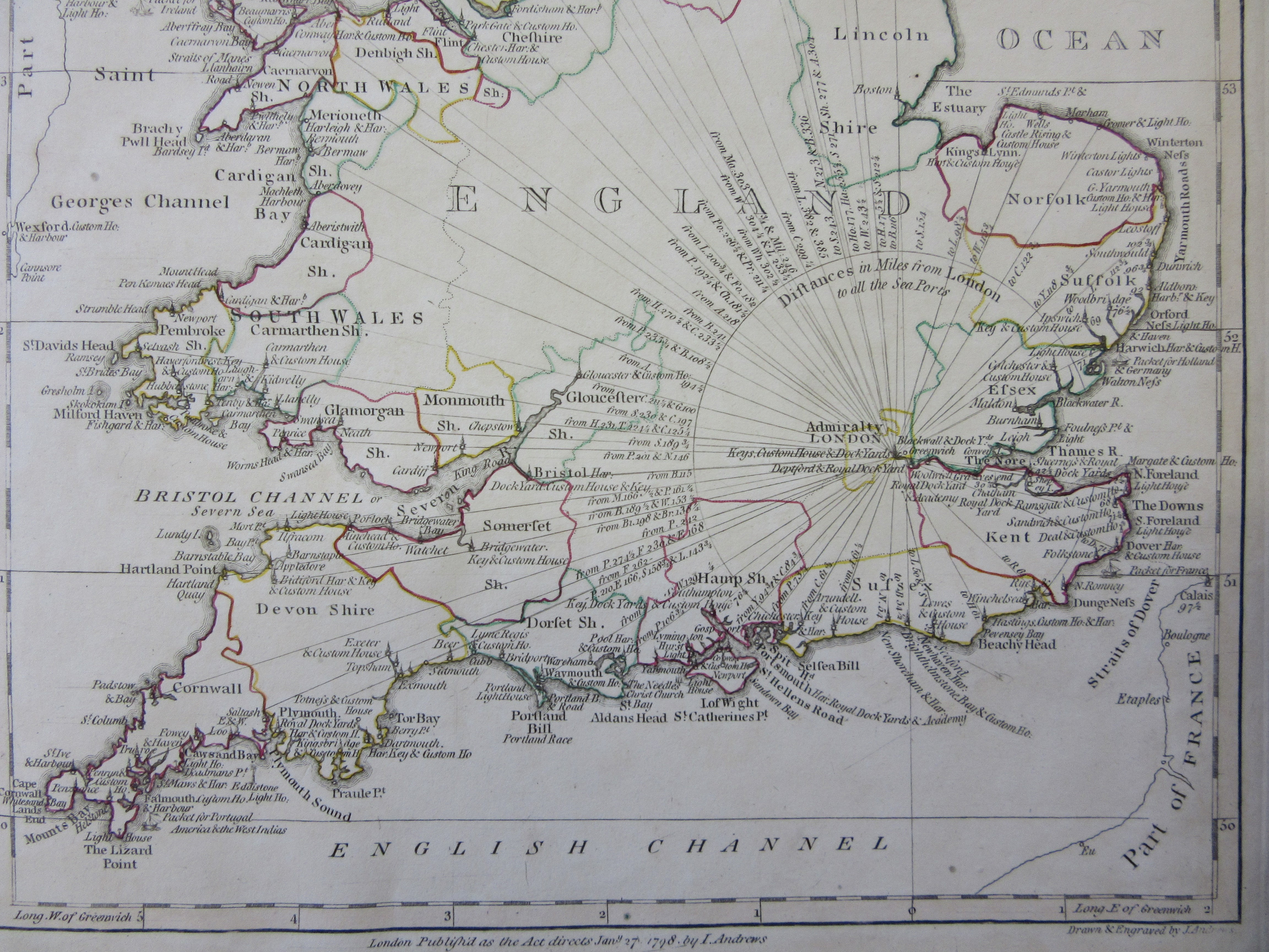
Most of the maps had been published before– they have dates mainly from the late 1790s – and some are too large for the binding and had to be folded in; possibly the atlas was cobbled together from existing stock. But for all that some of the maps are both beautiful and unusual and suggest different ways of looking at the country. There are also several maps showing the supposed division of South Britain at different periods in history, such as under the Saxon kingdoms and the Roman occupation; these reflect the contemporary vogue for antiquities and early British history, although the sources used for this information were of dubious accuracy. The atlas ends with a map showing pride in Britain’s naval supremacy (above), giving the maritime counties and compass directions from London.
Although the atlas covers England and Wales, the map titles refer only to England or occasionally South Britain. Wales is unaccountably slighted.
A geographical atlas of England, divided according to its natural, political, civil, ecclesiastical, ancient and modern divisions, to which is added a political chart of Europe, to shew the positions of all the sea-ports, promontories and distances, in order to trace the naval and commercial intercourse between Great Britain, Ireland and the continent. In a series of maps, on a plan entirely new. Calculated to illustrate the history of this country, and for the improvement of youth, by John Andrews. London : Printed for John Stockdale, 1809. Allen 359.


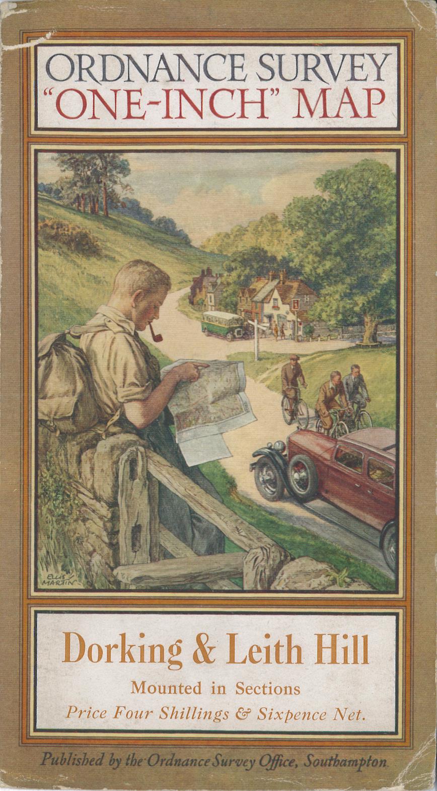

 In 1821 he married Selina Price of Radnorshire; there is uncertainty about the date of her birth but she appears to have been a few years his senior. We might have heard no more of Selina, were it not for the fact that Sidney Hall sadly died only 10 years later, at the age of 42. And yet his engraved maps continued to appear. New works engraved by Sidney Hall were published for decades after his death. Selina Hall, who conveniently shared a first initial with her husband, simply continued to engrave maps and signed them “S. Hall” (this as well as the date can be used to distinguish them from her husband’s work, since he usually signed “Sid.y Hall”), thus continuing to benefit from an established name.
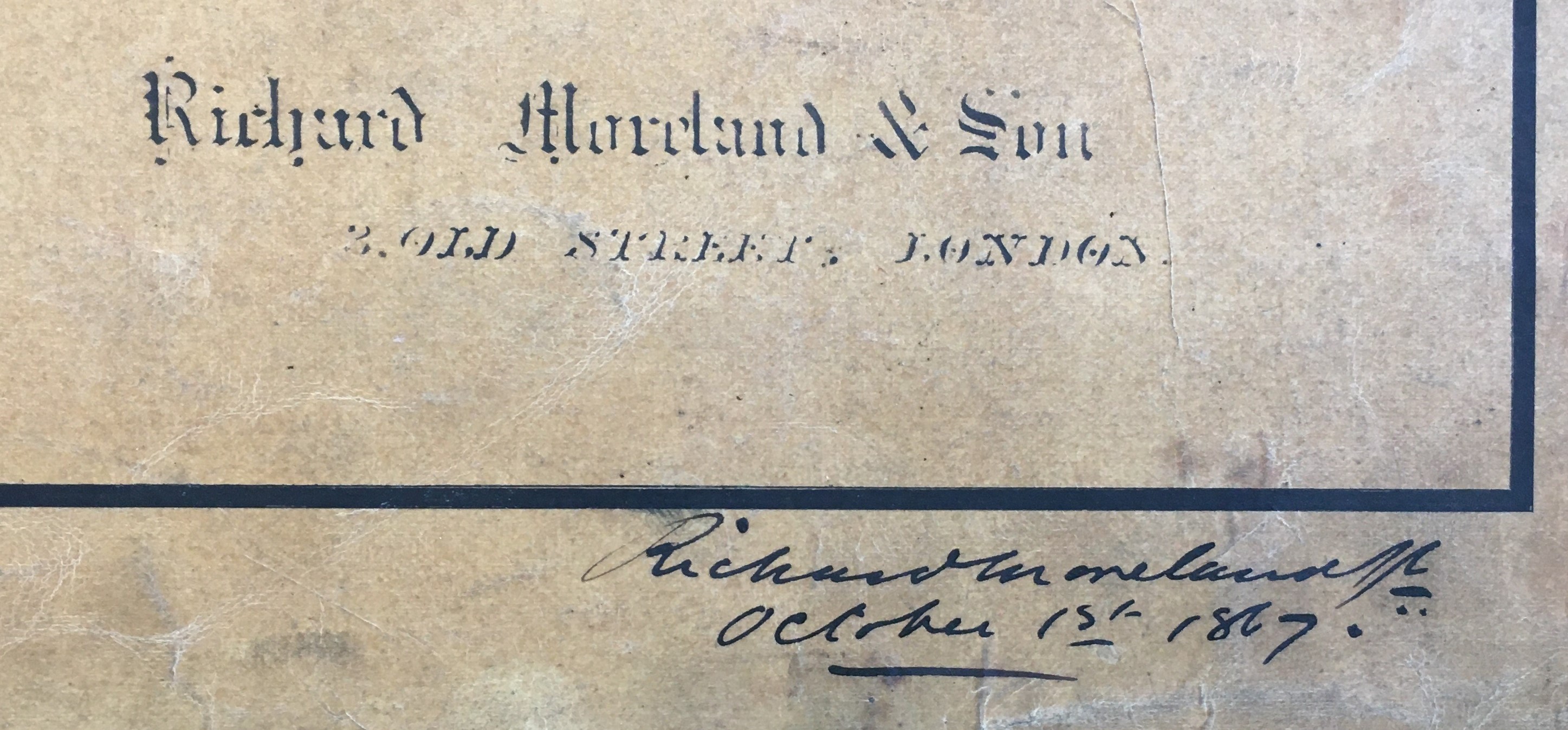
 Looking through a box of uncatalogued maps, plots and diagrams I came across several manuscript architectural plans of the Midland Grand Hotel, London. Now named the St Pancras Hotel it is an iconic landmark on the Euston Road next to that other celebrated edifice of red brick, the British Library. The plans, drawn to show the girders, were by engineer Richard Moreland of Old Street in 1867 at a scale of 10 feet to 1 inch (1:120). You can see all of the modern internal features with the Grand Staircase and the popular Ladies Coffee Room. There are even manuscript pencil marks denoting dimensions which indicate these were some sort of working drawings.