
Recent work on the Laxton map reminds us how beautiful maps often are, but also how beautiful the patterns made by field systems can be as well.
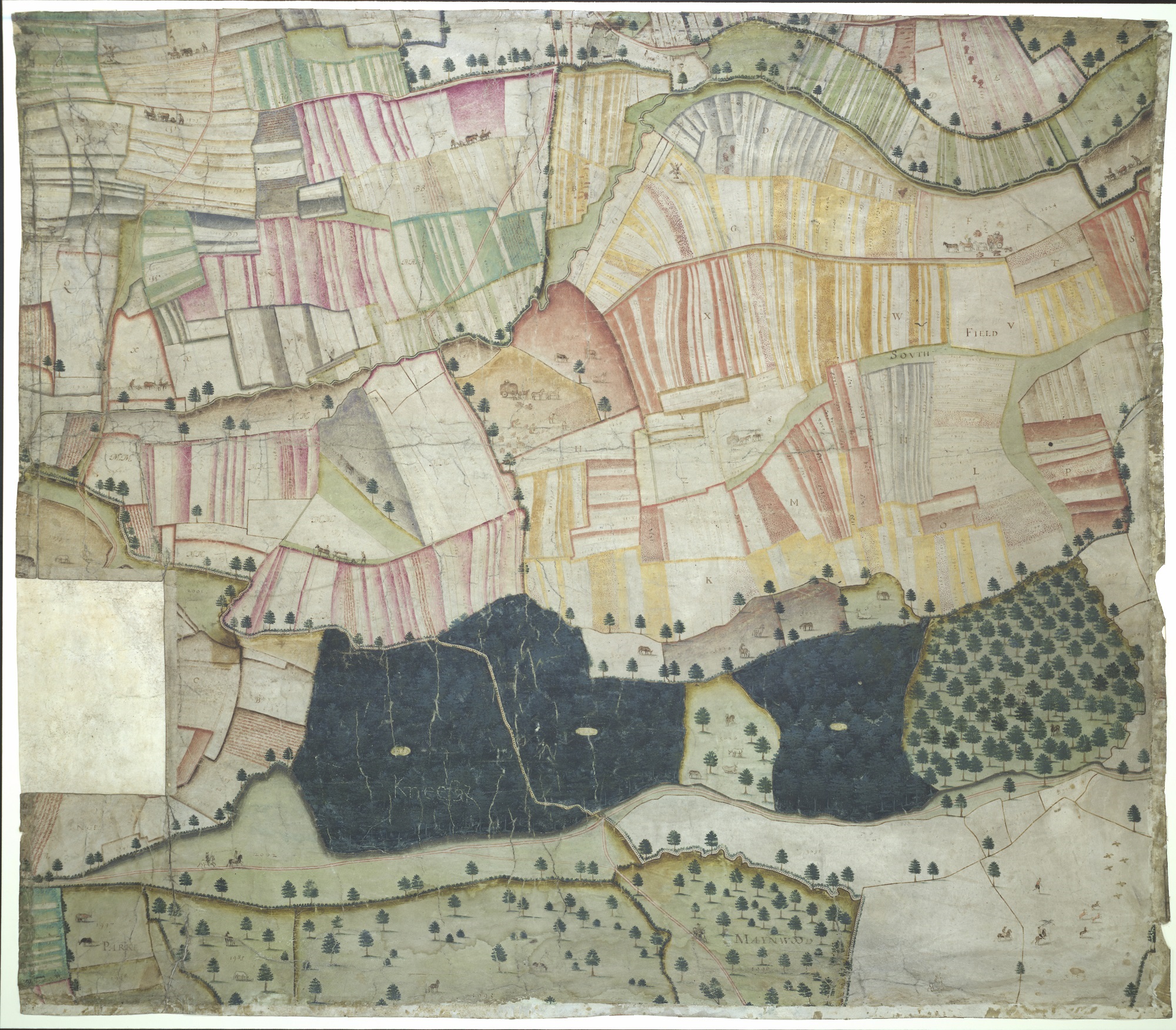
The central part of the Map of Laxton, 1635, MS. C17:48 (9) (see notes at end for more information on Laxton)
Fields are a natural part of the landscape, but the dating of the fields can vary greatly depending on where you are. Areas of the West Country still have what is called Ancient Countryside, fields and farm land untouched by Enclosure acts. Fields at the tip of Cornwall on
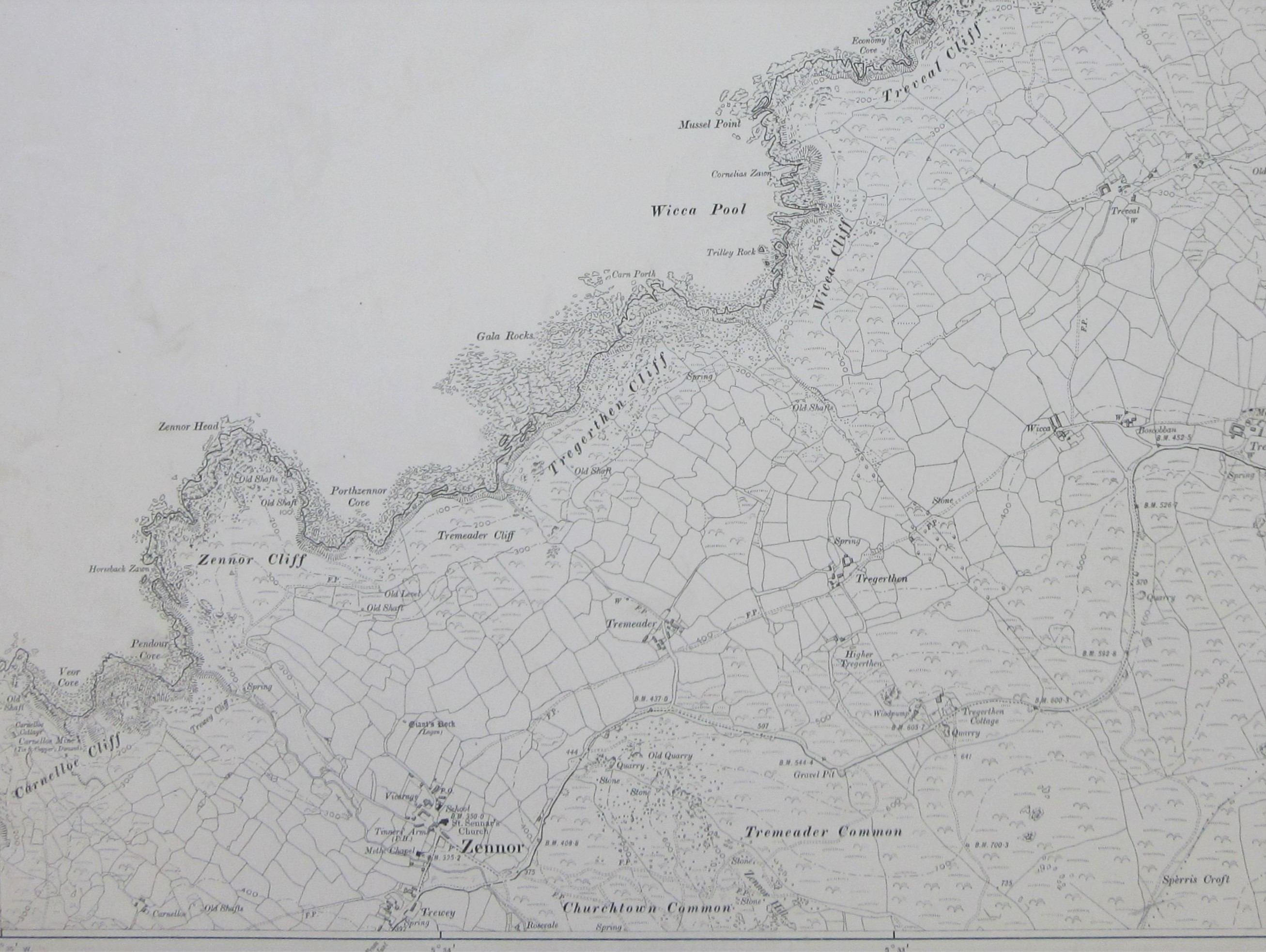
the Penwith Peninsula are thousands of years old, a crazy pattern with small fields and many angles, utilizing boulders in the landscape too big to move or pre-existing ancient monuments such as standing stones and burial chambers. Due to the construction of these boundaries they are hard to move or alter, and it’s because of this that these field boundaries are, despite their age, still in use today. This type of landscape can also be found in areas as diverse as the Welsh borders and Essex, Sussex, Kent and Surrey. This extract comes from the 2nd edition Ordnance Survey 6 inch map of Cornwall, sheet LXI S.W., 1908. The Ordnance Survey shows fields up to and including maps at a 1:25,000 scale.
Laxton is an example of an Estate map. These are almost always manuscripts, with a cartographer commissioned to survey and produce a map with details such as field size, use and often details of individual field ownership.
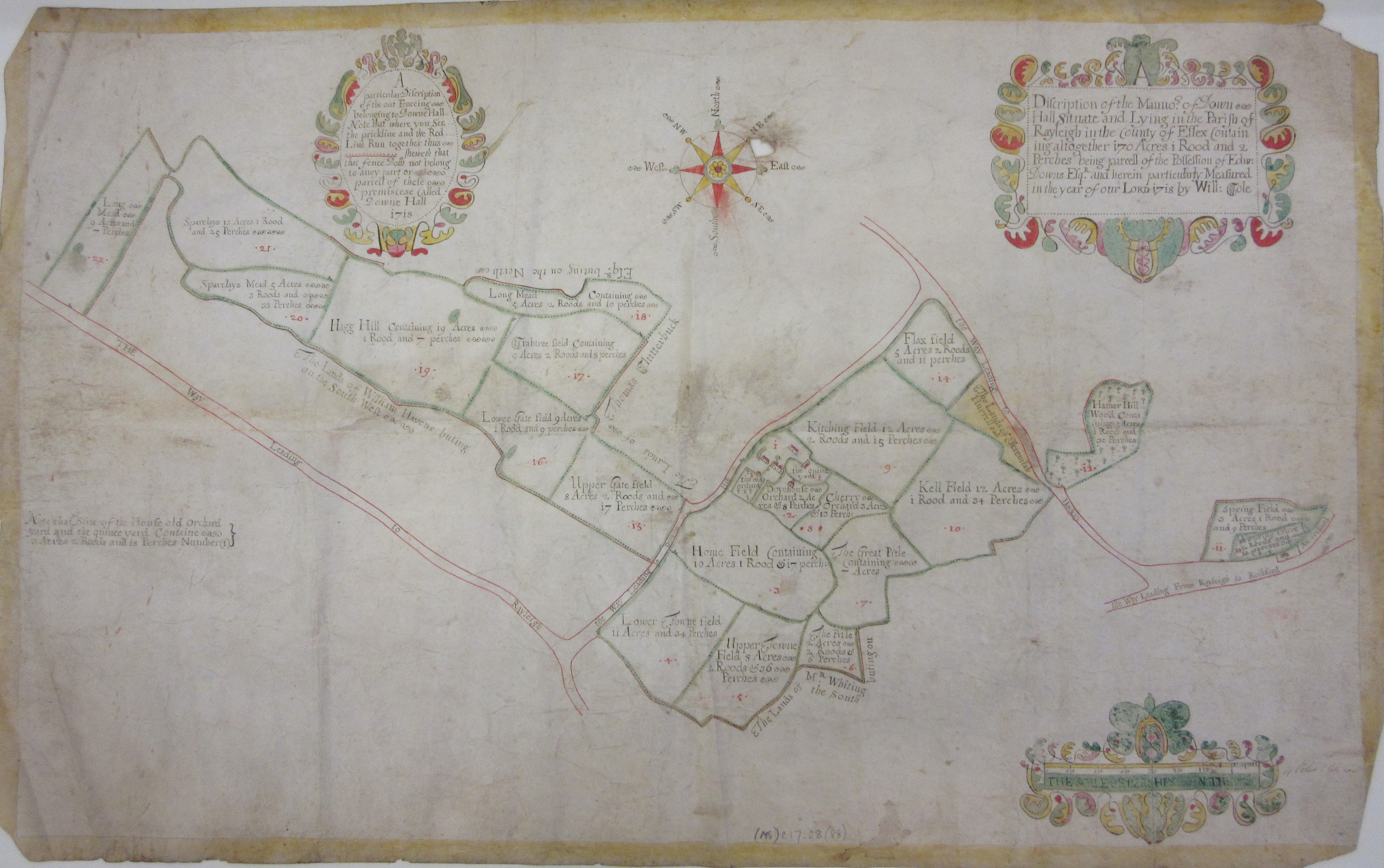
 Being a one-off often led to a beautifully illustrated and informative map. This example shows the fields surrounding the Down Hall Estate in Essex (MS C17:28 (38), 1718), and was surveyed by William Cole, who was also a schoolmaster in Colchester. Down Hall Estate (home of Bake Off no less) features in the middle of the map, with details of the kitchen gardens surrounding the house. Further examples of estate maps can be found here and here
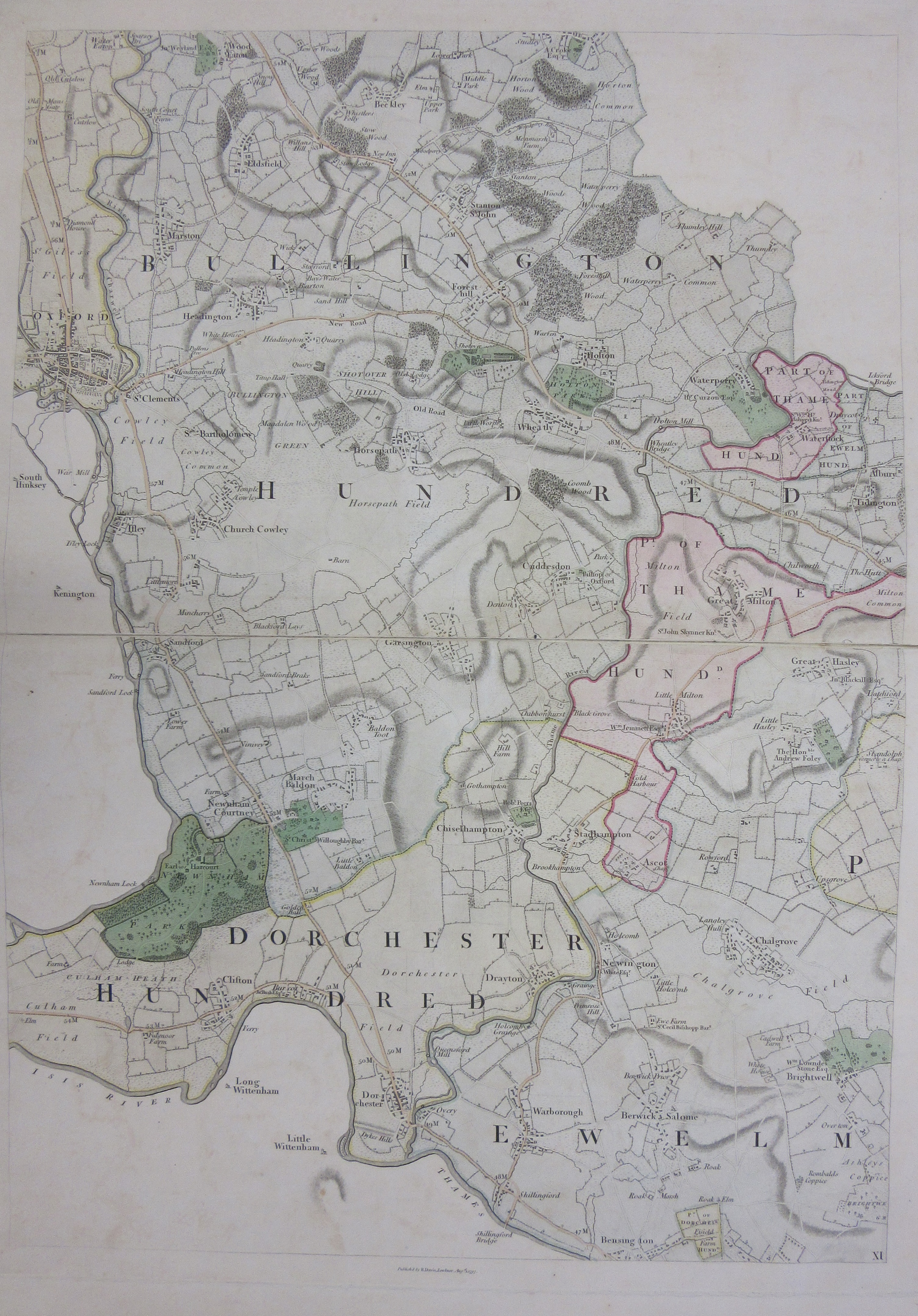
One of the best maps of Oxfordshire, Richard Davis’s map from 1797, falls in-between the old practise of open fields and the new approach, that of Enclosure. This sheet shows the area to the East of Oxford (the county boundary followed the Thames until the 1970s) and has both big open fields and the new, smaller, patterns in place. The map shows the start of a new type of landscape, called Planned Landscape, neat fields with straight lines, without any of the quirks found in older field patterns, which often followed ancient parish boundaries and streams.
with an extract here
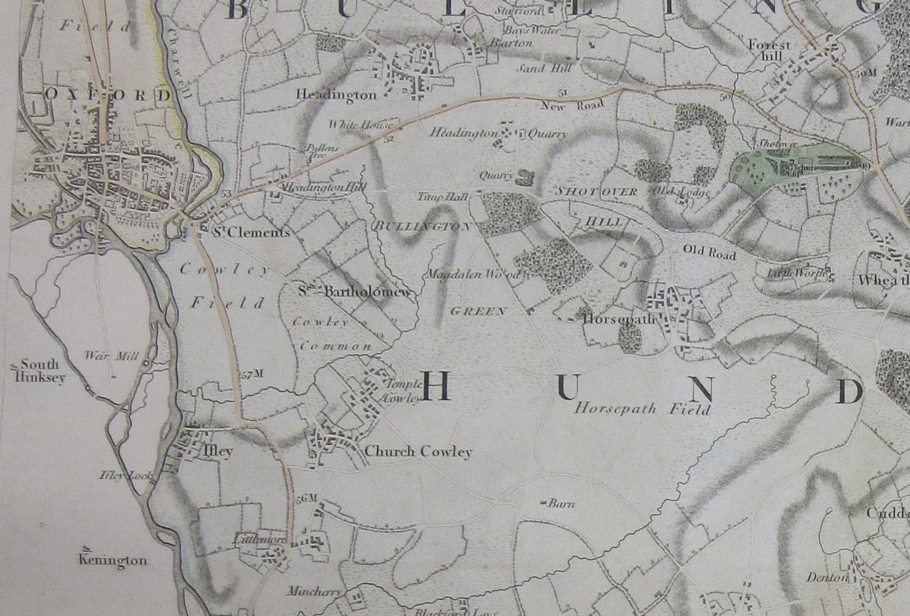
A new map of the County of Oxford : from an actual survey; on which are delineated; the course of the rivers and roads, the parks, gentlemens seats, heaths, woods, forests, commons &c. 1797 C17:49 a.1
This blog has been partly inspired but a recent series of programmes on the BBC called Winter Walks. Over 5 episodes people such as Simon Armitage, Baroness Sayeeda Warsi and the Rev. Richard Coles have walked in Yorkshire and Cumbria, holding a portable camera and accompanied by a drone giving aerial views of the incredible landscape and field systems on show. These field patterns can be seen in this Ordnance Survey 3rd edition sheet of Grassington (Yorks CXXXIV N.W., 1910). The field boundaries shown on the map would have been efficient way of using up stones found in the fields when ploughing. Dry-stone walling would also have the benefit of letting the wind through, reducing damage.

Be it from drone footage or walking in the country-side field patterns are revealed as objects of beauty as well as important agricultural features. They are also a chance for us to show off more beautiful maps from the collection at the Bodleian.
* The Laxton map, A Plat and Description of the Whole Mannor & Lordship of Laxton with Laxton Moorehouse in [y]e County of Nottingham and also of the Mannor & Lordship of Kneesall Lying Adiacent to [y]e Aforesaid Mannor of Laxton, measures 178 x 203.5 centimetres on 9 rectangular pieces covering the villages of Laxton and Kneesall, around a dozen kilometres northwest of Newark-on-Trent. Dating from 1635. Approximately 3,333 separate field strips are shown on the map, which is made from sheep-skin. The area is still farmed using the open-field system, incorporating crop rotation, though to a lesser extent than at the time of the map. The Map Librarian at the Bodleian, Nick Millea, talks about the map here
Pingback: Field patterns – GeoNe.ws