
Is there a more famous event in the history of London than the fire which started on the 2nd of September 1666? We call this the Great Fire to separate it from numerous conflagrations that had beset the city both before and after. One unexpected outcome of the disaster was the amount of mapping produced in the immediate aftermath, mainly to support the number of different proposals for redevelopment. One of quickest to print was this map, made a mere fortnight after the end of the fire by Valentine Knight.
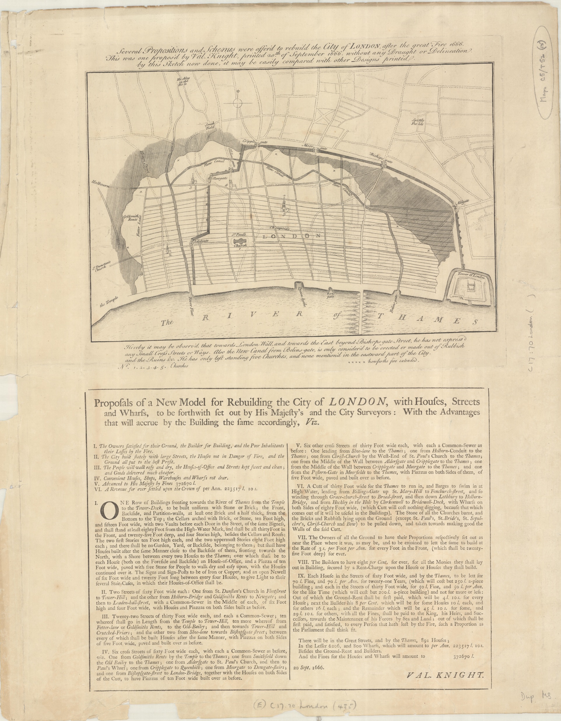
Several proportions and scheems were offer’d to rebuild the City of London after the great fire. This one was proposed by Val. Knight, 1666. (E) C17:70 London (485)
This hastily made map isn’t the important part of Knight’s proposals, that comes in the accompanying text which sets out his ideas for redevelopment. The map does give an immediate view of the damage caused by the fire though, almost all buildings in the City destroyed, including over 13,000 houses, close to 90 Parish Churches and then some of the major buildings within the City, including St Paul’s. Of his proposals number 9 suggested a way that the rebuilding could be paid for, setting out a scheme of rent and deposits that could be charged on the grander houses. In part of the proposal Knight writes ‘…with all the fines [fees] shall be paid to the King, his heirs and successors, towards the maintenance of his forces by land and sea…’. The idea that the King could profit from the fire so incensed Charles II that Knight was temporally imprisoned.

This neater map was made in the year of the fire by the diarist and contemporary of Samuel Pepys, John Evelyn. Evelyn’s plan allows for a neater layout of the City but was rejected as being too expensive and cumbersome with the large number of different land holders involved, as was Knight’s.
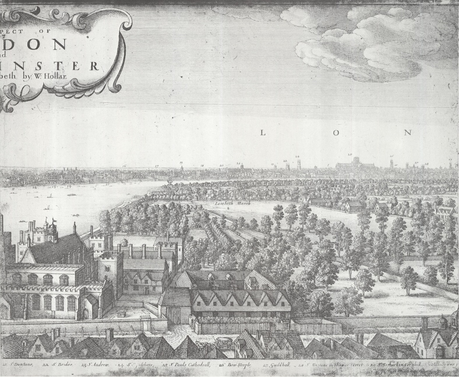
What with the destruction to life and property the fire made any earlier maps outdated, such as this wonderful panorama of the city (stitched together digitally from the three sheets that make up the set for this blog) which was printed earlier in the year of the fire by Wenceslaus Hollar

The Prospect of London and Westminster taken from Lambeth. Version I, the original state, 1666, C17:70 London (1365)
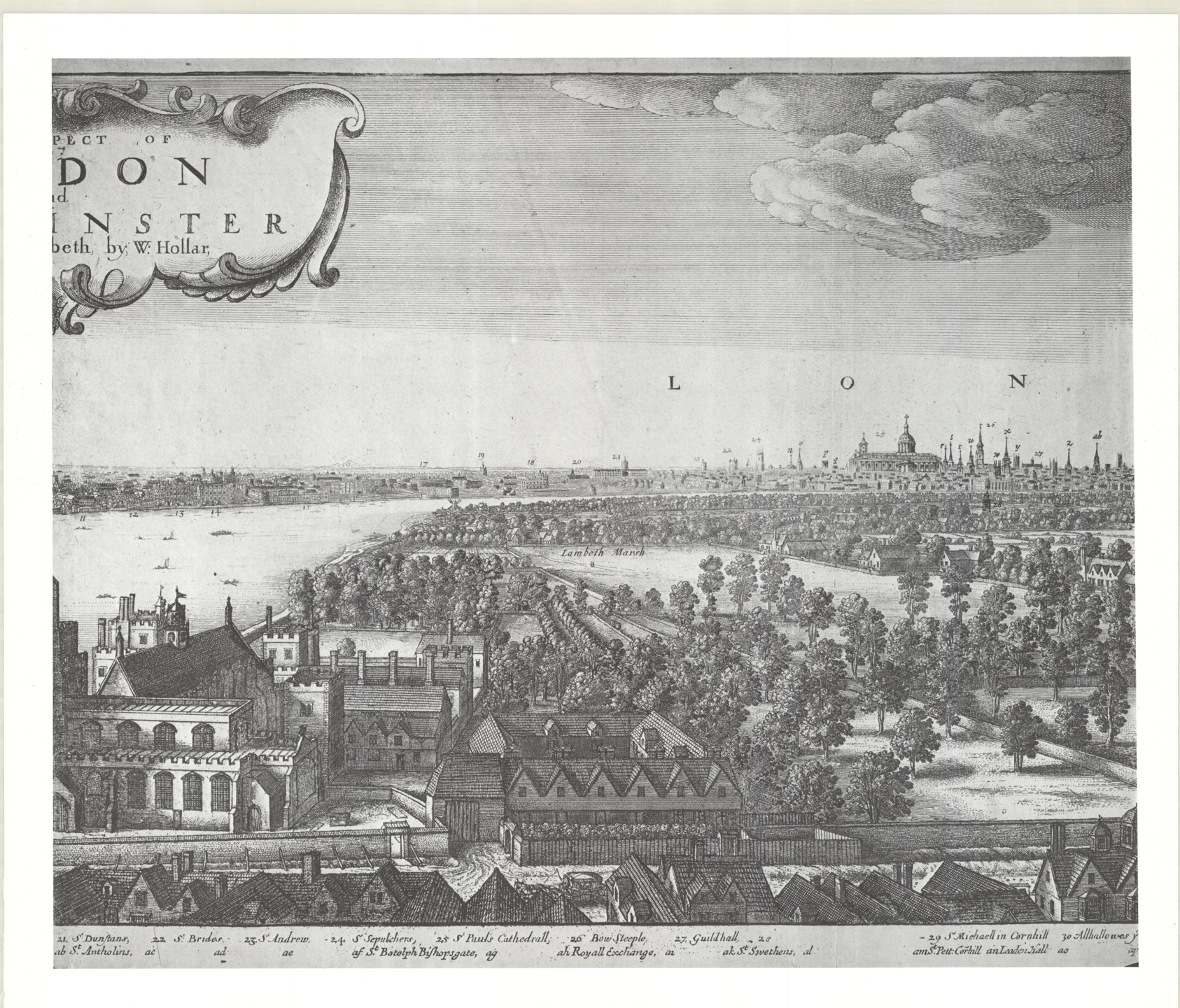
The view of the City, from Lambeth Palace from the south bank, shows a host of church spires, with in the middle of them all St Paul’s. All were destroyed so Hollar had to make a new map showing the post-fire cityscape. Here’s the original sheet covering the City
and here’s the revised sheet with the new St Paul’s and Parish Churches.
This image of the new design for the dome of St Paul’s is part of a small set of maps made by Sir Christopher Wren for the rebuilding of the Cathedral.
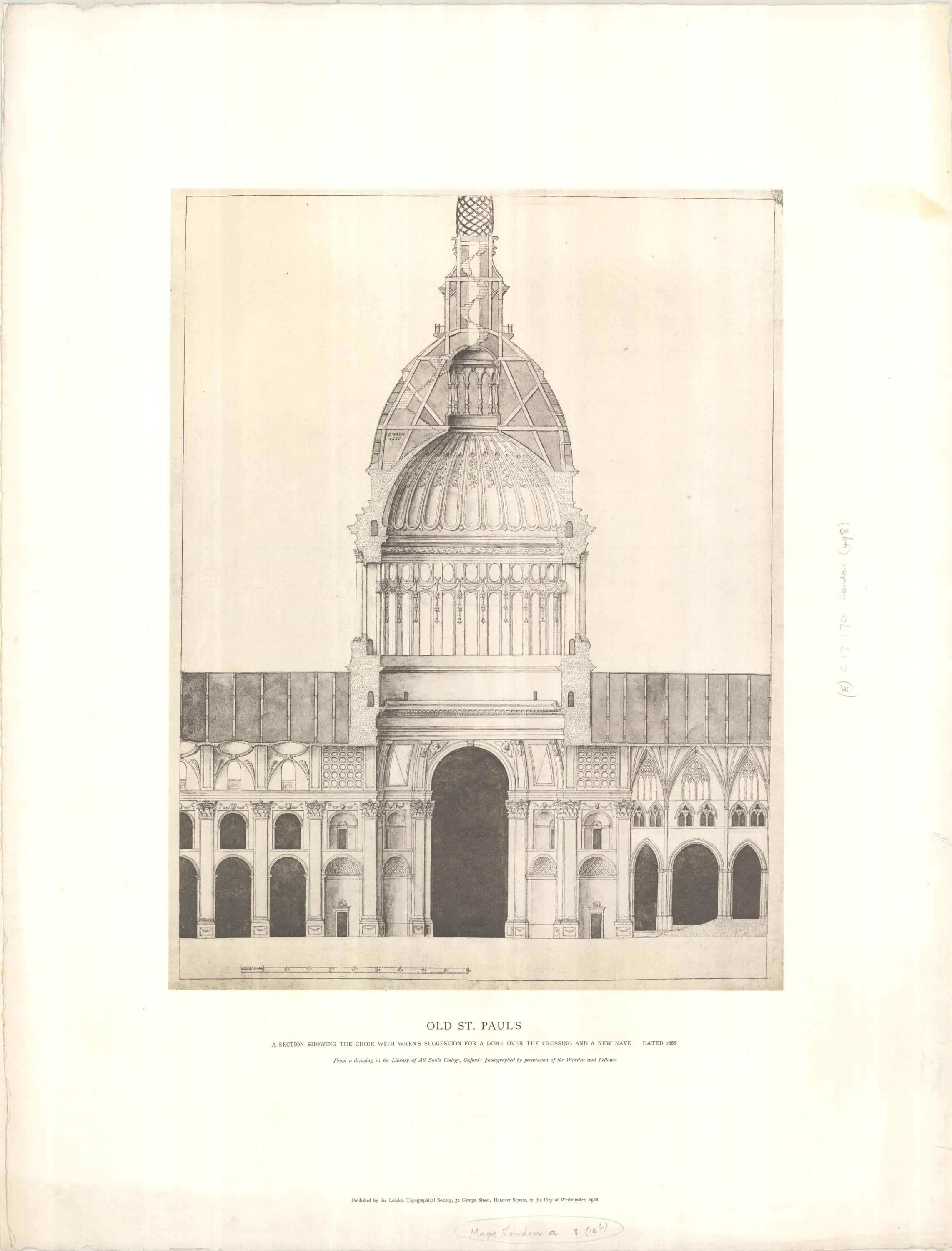
Old St Paul’s; a section showing the choir with Wren’s suggestion for a dome over the crossing and a new nave. [Together with] Ground plan, 1666. (E) C17:70 London (498).
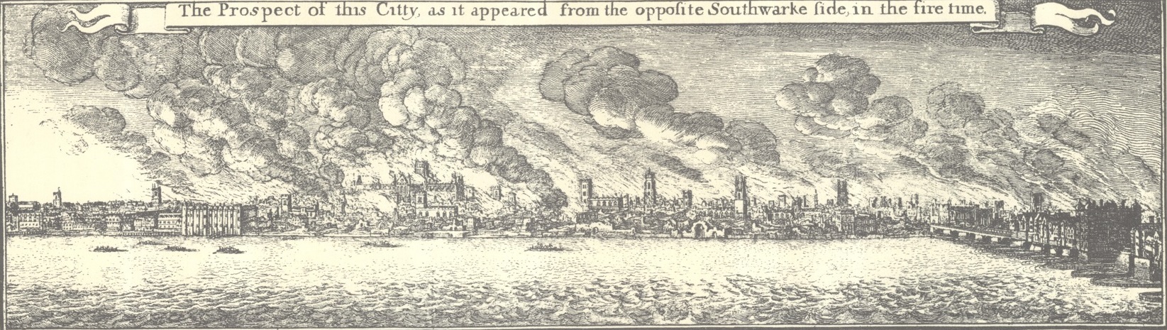
Hollar produced many maps of the city, including one showing the area destroyed in the flames. An inset shows the fire at its height
Pingback: Maps for the Aironauts…engravings by the best masters | Bodleian Map Room Blog