
 Our previous blog dealt with some of the first road maps aimed at motorists in the early twentieth century. Although people have been travelling by road for thousands of years, road maps themselves are a comparatively recent invention. Until the 1670s and the advent of John Ogilby’s strip maps, most maps did not show roads, Once the idea had been established it was soon extremely popular; it was widely copied in Britain and elsewhere. Amongst the many maps of the roads of England produced in the late seventeenth century, this is a particularly decorative example.
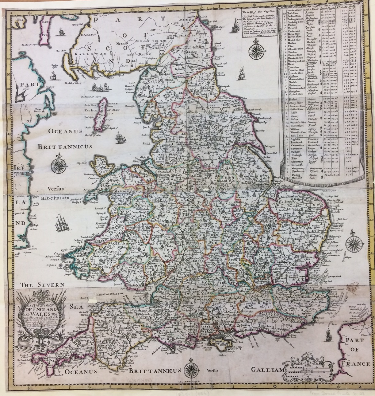
The map is titled “A new map of England and Wales with the direct and cros roads” (cross roads were those linking between the main roads). Distances between settlements are given in miles. Hand colouring of the county boundaries enhances the map but does not detract from the details. Beneath the decorative and closely written cartouche, two angry sea monsters are having a face off. The cartouche explains that the map is “Sold by Philip Lea Globemaker at the Atlas and Hercules in Cheapside near Fryday Street” (addresses were more fun in those days).
Top right there is a table with information about the counties, including the county town for each one; where this was a cathedral city there is a tiny picture of a bishop’s mitre to accompany the name.
The sea is illustrated with small pictures of ships, as was popular on maps of the time. More unusually, a previous owner of the map has tried their hand at reproducing one of these, and a tiny pen and ink sketch of a ship appears in the Channel along with the printed illustrations.
The map was originally published by Phillip Lea around 1689, in an atlas of England and Wales consisting mainly of Saxton’s county maps. This in itself is remarkable since Saxton’s maps were first published in the 1570s; over one hundred years later, the plates were still being updated, edited and reused (in fact their final use was not until about 50 years after this). To accompany these county maps, Lea included two maps of the whole of England and Wales: one general one, and this one which focused on the roads, thus bringing the atlas thoroughly up to date. It was also sold in a slightly later state as a separate sheet, and was available in four separate strips for greater portability; on the complete map, the joins of the four strips are clearly visible.
A new map of England and Wales with the direct and cros roads : also the number of miles between the townes on the roads by inspection in figures. [London] : Sold by Philip Lea Globemaker, [1689?]. (E) C17 (456)