
This collection of items relating to London is intriguing; four maps and a view, only loosely related, are bound together; all date from the eighteenth century and have a connection to London and its surroundings. The names of two former owners appear on the flyleaf, dating from the late nineteenth and early twentieth centuries, but the collection may have been assembled earlier.
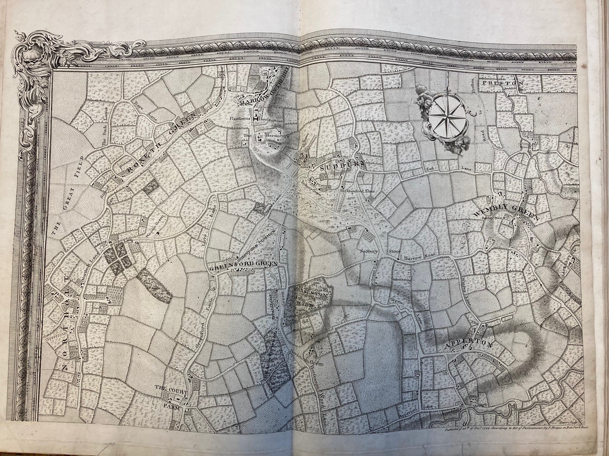
One of the maps in particular would be a treasure in any circumstances. John Rocque’s map, “An exact survey of the citys of London, Westminster, ye Borough of Southwark and the country near ten miles round,” is a famous and remarkable map. Made in the early 1740s and published in 1746, it covers London and the surrounding area on 16 sheets, from Harrow on the Hill in the northwest to Chislehurst, then in Kent, in the southeast. The map above is the top left hand (or north west) sheet.
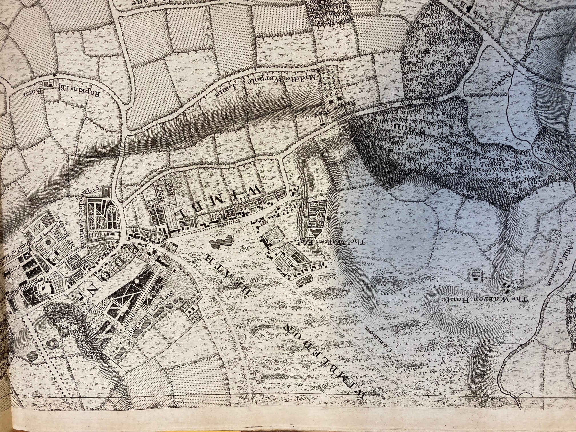
As London has grown so much in the intervening two and a half centuries, the area covered by the map is now all within the conurbation of London. At the time, most of the urban area of London was contained within just one of the 16 sheets, while all around the now familiar names of London suburbs appear as rural villages surrounded by fields. With remarkable prescience, John Rocque created a map, in the mid-eighteenth century, of the London of the future. The sheet above shows the rural villages of Harrow on the Hill, Sudbury and “Wembly Green”, with a beautiful compass rose. Below, from another sheet, we see Wimbledon Common (then Wimbledon Heath) much as it might have been in the young days of the oldest Womble, Uncle Bulgaria.
This particular copy is bound into a volume, but the Bodleian also holds a version that has been joined together to form one single massive sheet; this is shown below, with the Map Curator included for scale. The bound version here differs from the other recorded editions of this map, in that it has the title in English only; other copies have it in Latin and French as well, so it’s possible this is a proof state.
To return to the intriguing London volume, it also includes a reduction of the sixteen sheet map to a single sheet, giving an overview that further demonstrates how tiny the urban area of London was then. This was also made and published by John Rocque.

Rocque also made both printed and manuscript maps of individual estates. The next map in the volume, entitled “The plan of the house, gardens, park & plantations of Wanstead in the county of Essex,” was made in 1735. The mansion house at Wanstead had been completed in 1722, to replace an earlier manor house, and was owned by Earl Tylney. He received the title in 1731, so the map celebrates his new status as well as the beautiful house and grounds. The information at the bottom of the map is in French, so perhaps Rocque anticipated an international audience for this map of a new and fashionable estate; the landscaping had been inspired partly by the Palace of Versailles. There is an intriguing feature in the formal garden, shaped like a map of Great Britain.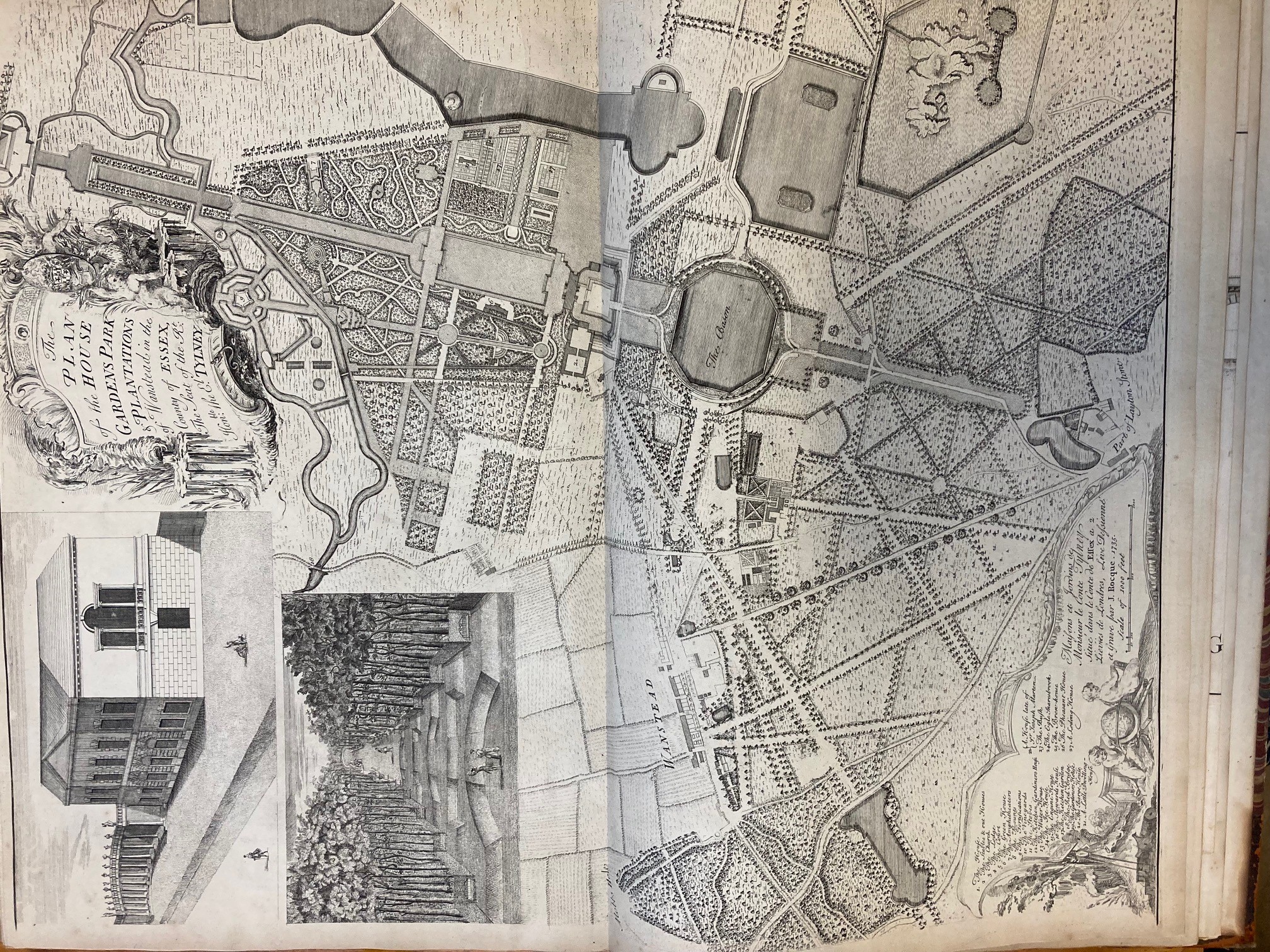
The Rocque maps are followed by an early example of a facsimile map (or more accurately, a derivative). In 1667 John Leake had made a map showing the City of London, with the extent of the Great Fire the previous year. George Vertue published a copy, slightly reduced but with some additional information, for the Society of Antiquaries in 1723. It shows the City of London, including the city walls and the boundary of the burnt area; a section of the upper left part of the map including the title is shown here.
Finally, there is a design for Westminster Bridge from 1739, a side elevation accompanied by smaller cross sections and plans. This was drawn by Charles Labelye, the engineer responsible for the first Westminster Bridge. The construction of the bridge began in 1739; by the following century it had deteriorated, and was replaced by the current Westminster Bridge in 1862.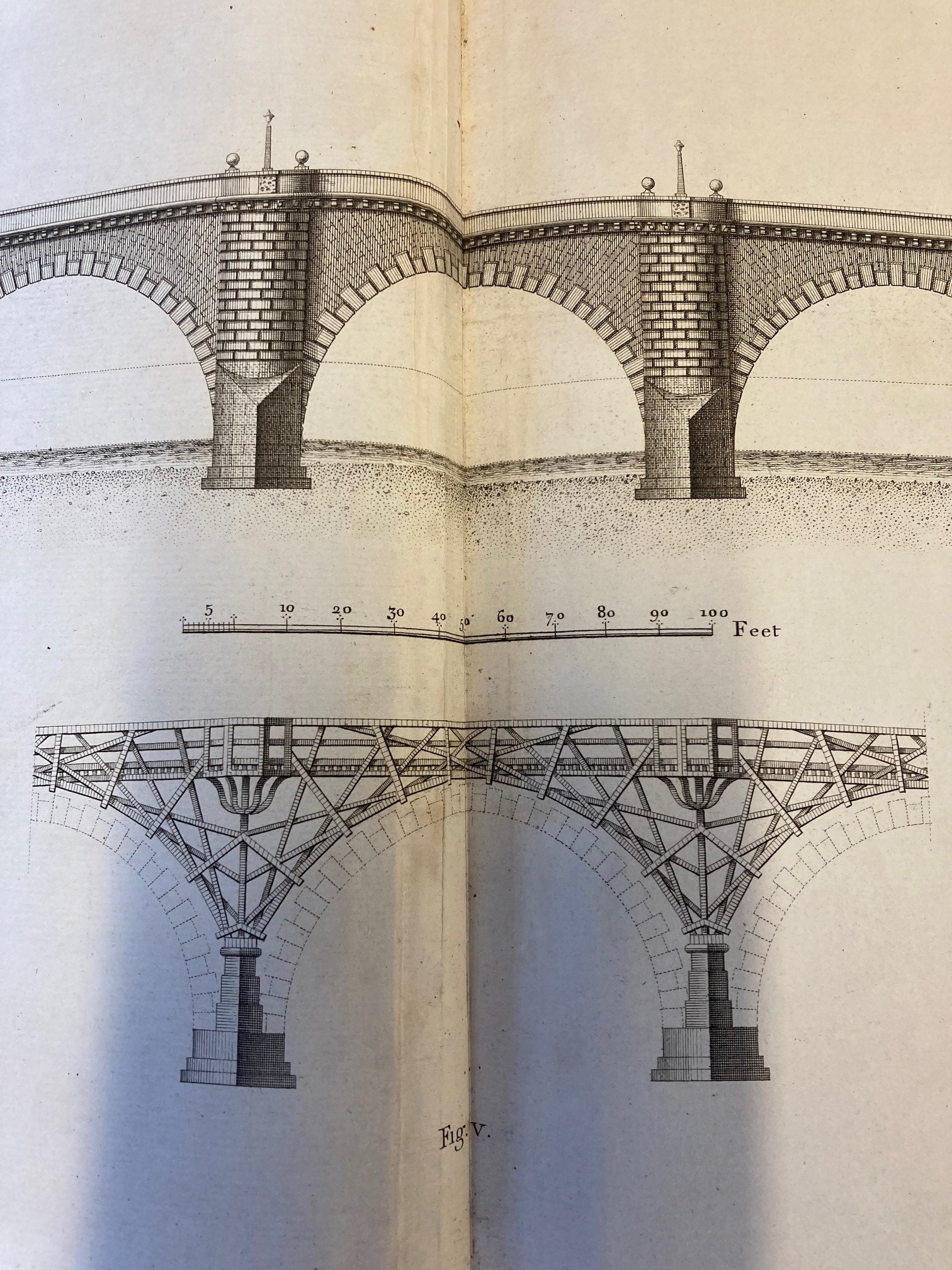
Past owners of the volume have also written personal notes on the blank page inside the cover. Samuel Ashton Thompson Yates has written brief notes on the contents of the volume. Thompson Yates was originally called Samuel Ashton Thompson, but added the Yates in accordance with the will of Joseph Brooks Yates, who was his grandfather, in 1867, so presumably acquired the volume after that date. He was a man of some wealth and influence; he went on to make a substantial donation to the construction of the Health Sciences building at the University of Liverpool, built 1894-9. (This information comes from The Centre for the Study of the legacies of British Slavery at University College London, and more can be seen here.)
In the twentieth century the atlas passed to Elizabeth Phebe Merivale, who notes that she was given it by her brother Hugh Bright in 1904. At some point after that, it arrived in the Bodleian Library, where it will remain.
Map Res. 127