
Gagingwell is a small hamlet in the north of Oxfordshire centred round a group of springs. In 1713 the land belonged to the Earl of Lichfield, and it is presumably the Earl who has commissioned this wonderful estate map.
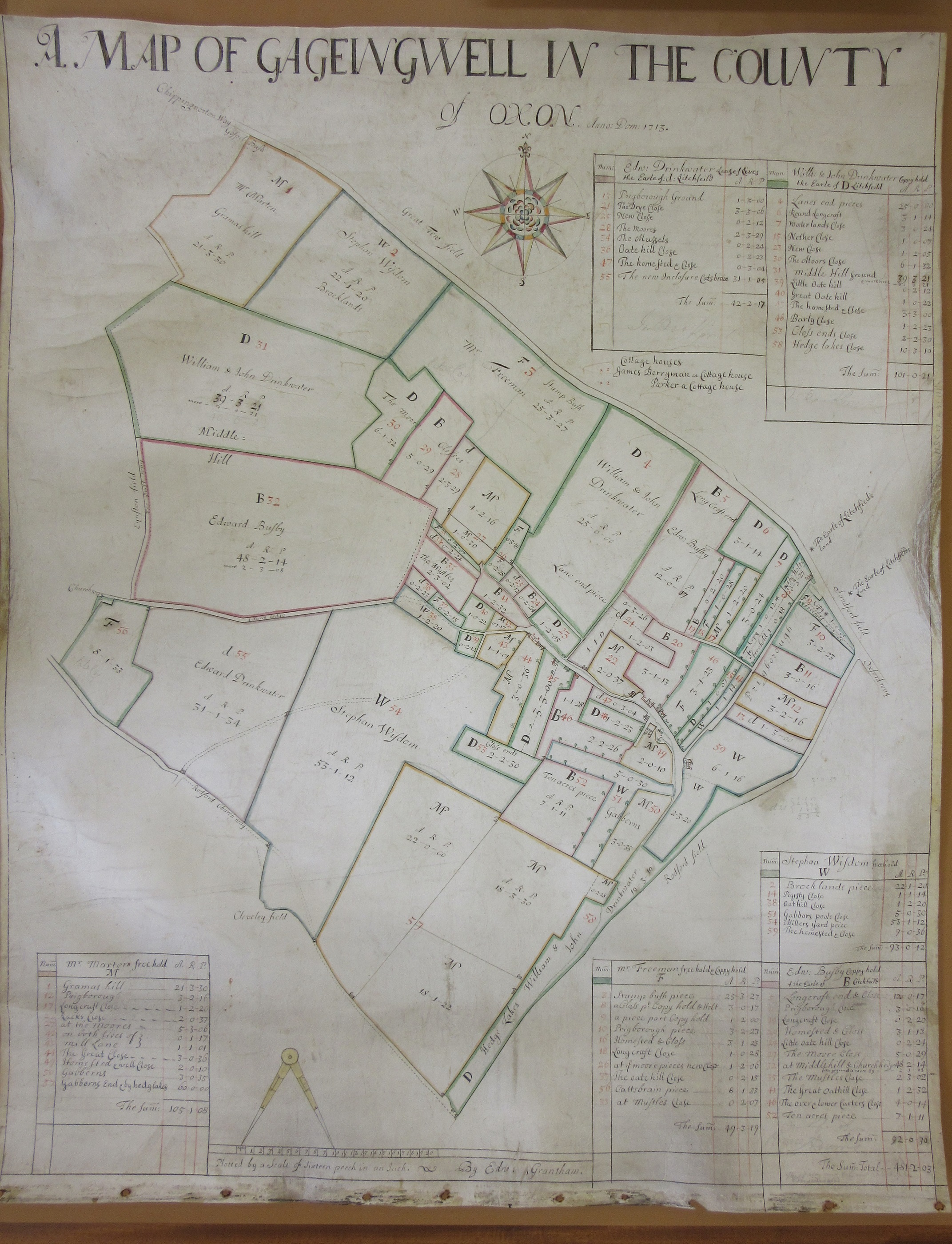
A map of Gagingwell in the County of Oxon, anno dom: 1713. 1713 (MS) C17:49 (111)
 An estate map is an administrative record of who owns or farms what on a particular estate. As a result they also often give a moment in time of that place, listing as it does individual villagers alive and active in the village at the time the map was drawn. So from over 300 years ago we get to see the fields and strips belonging to the villagers John, Edward and William Drinkwater (brothers? father and sons?), Stephen Wisdom, Edward Busby and Mr Marten and Mr Freeman. Estate maps can also be records of a lost landscape as many show areas pre-enclosure, before the replacing of the old open field system of agriculture in which villagers had a share of the land around their homes with the enclosed field and hedge system that is a recognizable but fairly recent part of our landscape. This change can be seen when the 1713 estate map is compared to the one the finest maps made of the county, Richard Davis’s 1797 map of Oxfordshire. Here’s Gagingwell from Davis, the pattern of small fields has been replaced by a field pattern recognizable today.
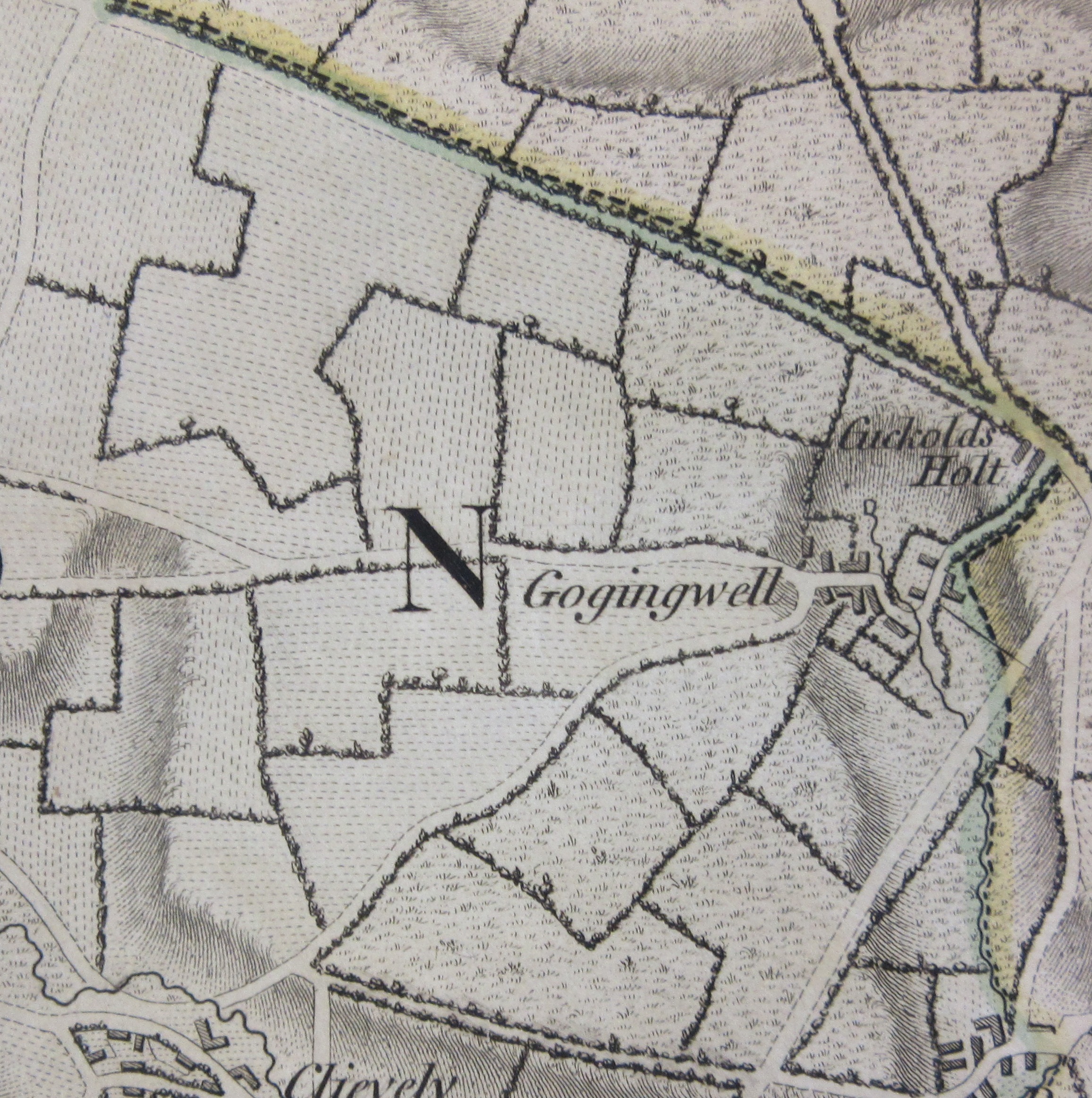
Extract from ‘A map of the county of Oxford…made in the years 1793 and 1794 by Richard Davis of Lewknor, topographer to his Majesty’ 1797 C17:49 a.1
The effects of enclosure on the local community were profound. Many of the poorer villagers were forced into the major county towns to find work or strike further afield, emigrating to the commonwealth countries of Australia, New Zealand, Canada and South Africa (a blog on emigration can be read here ).
The way that the open field system works can be seen in this extract from the estate map. The letters refer to the villagers owning land; d is Edward Drinkwater, D is William and John Drinkwater, W is the wonderfully named Stephen Wisdom, Edward Busby is B, Mr Freeman F and Mr Marten F.
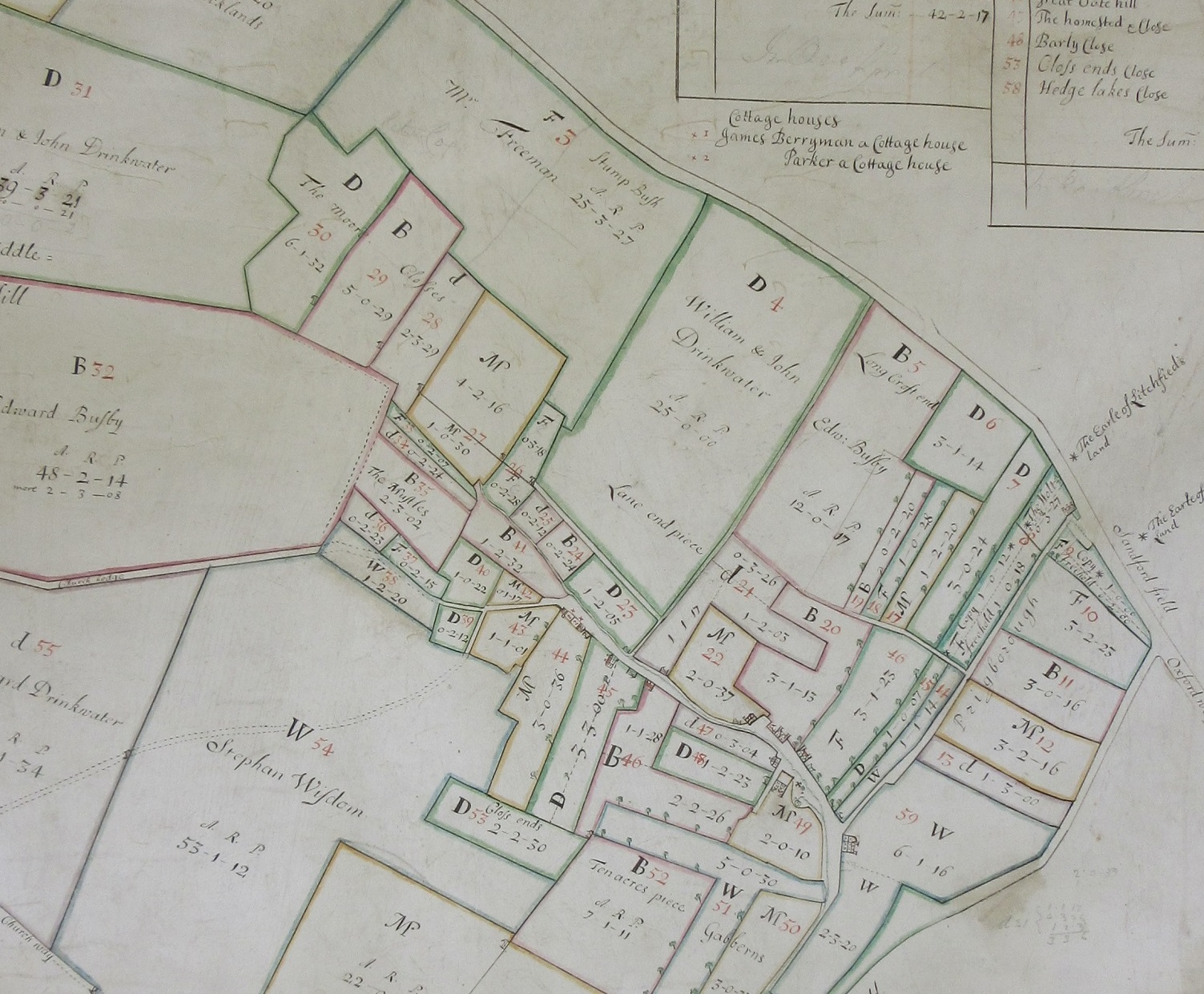
As can be seen individual ownership is spread across the hamlet. This had a two-fold purpose. First it gave equal amounts of good, indifferent and poor quality land evenly and it meant that with a crop rotation system in place all would have land in fields growing different crops as well as a field left fallow each year.
There’s a confusing mix of different terms for tenancy on the map. Wisdom, Freeman and Busby are freeholders, the rest leased their land from the Earl of Lichfield, some for a period of time while Edward Drinkwater leases his land for the duration of his life, ‘lease f[or] lives’. Some of the villagers also have a ‘Coppy hold’ agreement with the Earl, meaning they have the rights to land at the will of the Earl.
Called Litchfield on the map The title Earl of Lichfield was granted to Edward Henry Lee by Charles II in 1674 when he was 11, and had arranged to be married to the illegitimate daughter of Charles and Barbara Villiers, the Lady Charlotte Fitzroy, who was 9. They were married a few years later, aged 14 and 13. The couple went on to have 18 children, 7 dying before adulthood, and their country seat was Ditchley Park, a few miles south of Gagingwell.
 Ideally when writing a blog about a map of somewhere in Britain you would want to include if possible the Ordnance Survey County Series mapping at 1:2,500. Easily the best maps made covering Britain, and arguably the best maps covering anywhere in the World, especially the beautifully coloured 1st ed sheets. These show individual buildings, fields, trees and topographical features and would have been perfect for a blog such as this. Unfortunately Gagingwell suffers from the curse of sheet mapping, being as it is on the corner of 4 different sheets!
The estate map was drawn by Edward Grantham, a cartographer specializing in estate and enclosure maps and is at the scale of ‘sixteen perch in an inch’. A perch was a rod used for measuring land, usually at 5¹/₂ yards, though there were local variations. A modern scale would be approximately 1:3,168.
